You are here: Home > Network List > TA - USArray Transportable Network (new EarthScope stations) Stations List
> Station G59A Clarenceville, QC, USA > Earthquake Result Viewer
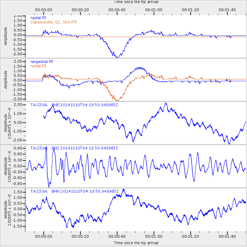
G59A Clarenceville, QC, USA - Earthquake Result Viewer
*The percent match for this event was below the threshold and hence no stack was calculated.
| Earthquake location: |
Southern East Pacific Rise |
| Earthquake latitude/longitude: |
-32.2/-110.8 |
| Earthquake time(UTC): |
2014/10/10 (283) 04:07:51 GMT |
| Earthquake Depth: |
10 km |
| Earthquake Magnitude: |
5.5 MWP |
| Earthquake Catalog/Contributor: |
NEIC PDE/NEIC COMCAT |
|
| Network: |
TA USArray Transportable Network (new EarthScope stations) |
| Station: |
G59A Clarenceville, QC, USA |
| Lat/Lon: |
45.08 N/73.18 W |
| Elevation: |
36 m |
|
| Distance: |
84.2 deg |
| Az: |
25.771 deg |
| Baz: |
211.349 deg |
| Ray Param: |
$rayparam |
*The percent match for this event was below the threshold and hence was not used in the summary stack. |
|
| Radial Match: |
17.072279 % |
| Radial Bump: |
400 |
| Transverse Match: |
22.903046 % |
| Transverse Bump: |
400 |
| SOD ConfigId: |
803114 |
| Insert Time: |
2014-10-24 04:45:42.921 +0000 |
| GWidth: |
2.5 |
| Max Bumps: |
400 |
| Tol: |
0.001 |
|
Signal To Noise
| Channel | StoN | STA | LTA |
| TA:G59A: :BHZ:20141010T04:19:50.949985Z | 3.393084 | 6.006494E-7 | 1.7702166E-7 |
| TA:G59A: :BHN:20141010T04:19:50.949985Z | 0.43839657 | 3.053106E-7 | 6.964256E-7 |
| TA:G59A: :BHE:20141010T04:19:50.949985Z | 0.68048126 | 5.1759224E-7 | 7.6062673E-7 |
| Arrivals |
| Ps | |
| PpPs | |
| PsPs/PpSs | |


