You are here: Home > Network List > TA - USArray Transportable Network (new EarthScope stations) Stations List
> Station I61A Oroboro, Fairlee, VT, USA > Earthquake Result Viewer
I61A Oroboro, Fairlee, VT, USA - Earthquake Result Viewer
*The percent match for this event was below the threshold and hence no stack was calculated.
| Earthquake location: |
Southern East Pacific Rise |
| Earthquake latitude/longitude: |
-32.2/-110.8 |
| Earthquake time(UTC): |
2014/10/10 (283) 04:07:51 GMT |
| Earthquake Depth: |
10 km |
| Earthquake Magnitude: |
5.5 MWP |
| Earthquake Catalog/Contributor: |
NEIC PDE/NEIC COMCAT |
|
| Network: |
TA USArray Transportable Network (new EarthScope stations) |
| Station: |
I61A Oroboro, Fairlee, VT, USA |
| Lat/Lon: |
43.93 N/72.21 W |
| Elevation: |
287 m |
|
| Distance: |
83.6 deg |
| Az: |
26.973 deg |
| Baz: |
212.156 deg |
| Ray Param: |
$rayparam |
*The percent match for this event was below the threshold and hence was not used in the summary stack. |
|
| Radial Match: |
58.11849 % |
| Radial Bump: |
400 |
| Transverse Match: |
71.083626 % |
| Transverse Bump: |
400 |
| SOD ConfigId: |
803114 |
| Insert Time: |
2014-10-24 04:46:36.309 +0000 |
| GWidth: |
2.5 |
| Max Bumps: |
400 |
| Tol: |
0.001 |
|
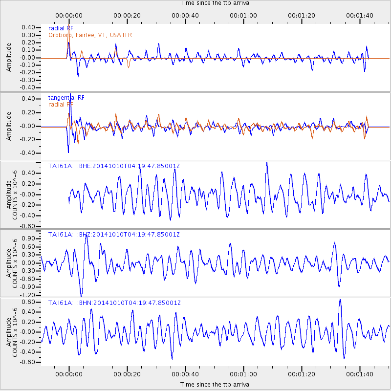
Signal To Noise
| Channel | StoN | STA | LTA |
| TA:I61A: :BHZ:20141010T04:19:47.85001Z | 2.2526817 | 5.6785467E-7 | 2.520794E-7 |
| TA:I61A: :BHN:20141010T04:19:47.85001Z | 1.4346958 | 2.1387345E-7 | 1.4907233E-7 |
| TA:I61A: :BHE:20141010T04:19:47.85001Z | 1.3179477 | 2.4419722E-7 | 1.8528598E-7 |
| Arrivals |
| Ps | |
| PpPs | |
| PsPs/PpSs | |


