You are here: Home > Network List > TA - USArray Transportable Network (new EarthScope stations) Stations List
> Station J62A Henniker, NH, USA > Earthquake Result Viewer
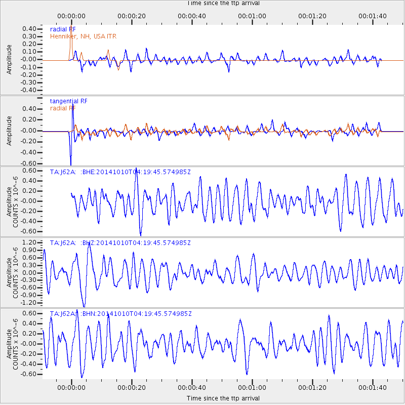
J62A Henniker, NH, USA - Earthquake Result Viewer
*The percent match for this event was below the threshold and hence no stack was calculated.
| Earthquake location: |
Southern East Pacific Rise |
| Earthquake latitude/longitude: |
-32.2/-110.8 |
| Earthquake time(UTC): |
2014/10/10 (283) 04:07:51 GMT |
| Earthquake Depth: |
10 km |
| Earthquake Magnitude: |
5.5 MWP |
| Earthquake Catalog/Contributor: |
NEIC PDE/NEIC COMCAT |
|
| Network: |
TA USArray Transportable Network (new EarthScope stations) |
| Station: |
J62A Henniker, NH, USA |
| Lat/Lon: |
43.23 N/71.81 W |
| Elevation: |
266 m |
|
| Distance: |
83.1 deg |
| Az: |
27.598 deg |
| Baz: |
212.501 deg |
| Ray Param: |
$rayparam |
*The percent match for this event was below the threshold and hence was not used in the summary stack. |
|
| Radial Match: |
57.04917 % |
| Radial Bump: |
371 |
| Transverse Match: |
68.74974 % |
| Transverse Bump: |
400 |
| SOD ConfigId: |
803114 |
| Insert Time: |
2014-10-24 04:47:05.912 +0000 |
| GWidth: |
2.5 |
| Max Bumps: |
400 |
| Tol: |
0.001 |
|
Signal To Noise
| Channel | StoN | STA | LTA |
| TA:J62A: :BHZ:20141010T04:19:45.574985Z | 2.1021457 | 7.109285E-7 | 3.3819185E-7 |
| TA:J62A: :BHN:20141010T04:19:45.574985Z | 1.6641402 | 4.2341733E-7 | 2.544361E-7 |
| TA:J62A: :BHE:20141010T04:19:45.574985Z | 0.9804819 | 2.1767032E-7 | 2.2200341E-7 |
| Arrivals |
| Ps | |
| PpPs | |
| PsPs/PpSs | |


