You are here: Home > Network List > AV - Alaska Volcano Observatory Stations List
> Station MAPS Pakushin Southeast, Makushin Volcano, Alaska > Earthquake Result Viewer
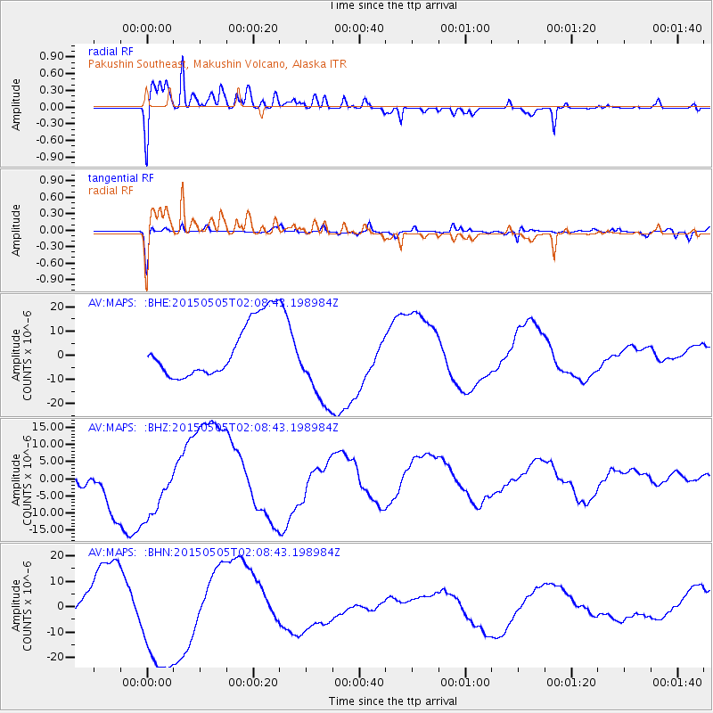
MAPS Pakushin Southeast, Makushin Volcano, Alaska - Earthquake Result Viewer
*The percent match for this event was below the threshold and hence no stack was calculated.
| Earthquake location: |
New Britain Region, P.N.G. |
| Earthquake latitude/longitude: |
-5.3/152.2 |
| Earthquake time(UTC): |
2015/05/05 (125) 01:58:20 GMT |
| Earthquake Depth: |
58 km |
| Earthquake Magnitude: |
5.6 MB |
| Earthquake Catalog/Contributor: |
NEIC PDE/NEIC COMCAT |
|
| Network: |
AV Alaska Volcano Observatory |
| Station: |
MAPS Pakushin Southeast, Makushin Volcano, Alaska |
| Lat/Lon: |
53.81 N/166.94 W |
| Elevation: |
333 m |
|
| Distance: |
68.1 deg |
| Az: |
24.731 deg |
| Baz: |
224.625 deg |
| Ray Param: |
$rayparam |
*The percent match for this event was below the threshold and hence was not used in the summary stack. |
|
| Radial Match: |
73.875725 % |
| Radial Bump: |
400 |
| Transverse Match: |
86.87767 % |
| Transverse Bump: |
400 |
| SOD ConfigId: |
7422571 |
| Insert Time: |
2019-04-18 16:11:47.594 +0000 |
| GWidth: |
2.5 |
| Max Bumps: |
400 |
| Tol: |
0.001 |
|
Signal To Noise
| Channel | StoN | STA | LTA |
| AV:MAPS: :BHZ:20150505T02:08:43.198984Z | 1.5625339 | 9.348187E-6 | 5.98271E-6 |
| AV:MAPS: :BHN:20150505T02:08:43.198984Z | 2.8283699 | 2.3267889E-5 | 8.226608E-6 |
| AV:MAPS: :BHE:20150505T02:08:43.198984Z | 1.5669056 | 1.8000512E-5 | 1.1487937E-5 |
| Arrivals |
| Ps | |
| PpPs | |
| PsPs/PpSs | |


