You are here: Home > Network List > US - United States National Seismic Network Stations List
> Station AMTX Amarillo, Texas, USA > Earthquake Result Viewer
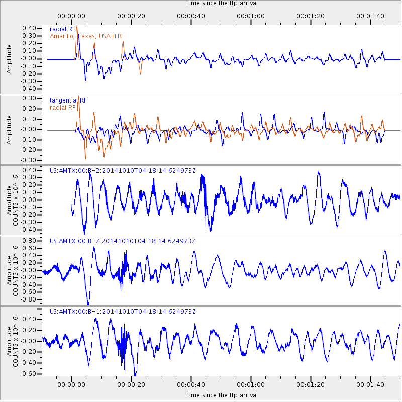
AMTX Amarillo, Texas, USA - Earthquake Result Viewer
*The percent match for this event was below the threshold and hence no stack was calculated.
| Earthquake location: |
Southern East Pacific Rise |
| Earthquake latitude/longitude: |
-32.2/-110.8 |
| Earthquake time(UTC): |
2014/10/10 (283) 04:07:51 GMT |
| Earthquake Depth: |
10 km |
| Earthquake Magnitude: |
5.5 MWP |
| Earthquake Catalog/Contributor: |
NEIC PDE/NEIC COMCAT |
|
| Network: |
US United States National Seismic Network |
| Station: |
AMTX Amarillo, Texas, USA |
| Lat/Lon: |
34.53 N/101.41 W |
| Elevation: |
1010 m |
|
| Distance: |
67.0 deg |
| Az: |
8.424 deg |
| Baz: |
188.652 deg |
| Ray Param: |
$rayparam |
*The percent match for this event was below the threshold and hence was not used in the summary stack. |
|
| Radial Match: |
62.09335 % |
| Radial Bump: |
400 |
| Transverse Match: |
51.848076 % |
| Transverse Bump: |
371 |
| SOD ConfigId: |
803114 |
| Insert Time: |
2014-10-24 04:54:31.617 +0000 |
| GWidth: |
2.5 |
| Max Bumps: |
400 |
| Tol: |
0.001 |
|
Signal To Noise
| Channel | StoN | STA | LTA |
| US:AMTX:00:BHZ:20141010T04:18:14.624973Z | 2.2622416 | 1.9076236E-7 | 8.432448E-8 |
| US:AMTX:00:BH1:20141010T04:18:14.624973Z | 0.68627614 | 7.1584026E-8 | 1.04307915E-7 |
| US:AMTX:00:BH2:20141010T04:18:14.624973Z | 0.5688653 | 1.0339054E-7 | 1.8174872E-7 |
| Arrivals |
| Ps | |
| PpPs | |
| PsPs/PpSs | |


