You are here: Home > Network List > US - United States National Seismic Network Stations List
> Station LAO LASA Array, Montana, USA > Earthquake Result Viewer
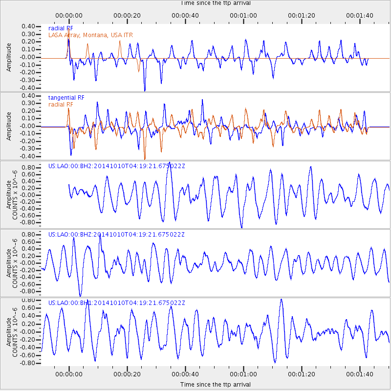
LAO LASA Array, Montana, USA - Earthquake Result Viewer
*The percent match for this event was below the threshold and hence no stack was calculated.
| Earthquake location: |
Southern East Pacific Rise |
| Earthquake latitude/longitude: |
-32.2/-110.8 |
| Earthquake time(UTC): |
2014/10/10 (283) 04:07:51 GMT |
| Earthquake Depth: |
10 km |
| Earthquake Magnitude: |
5.5 MWP |
| Earthquake Catalog/Contributor: |
NEIC PDE/NEIC COMCAT |
|
| Network: |
US United States National Seismic Network |
| Station: |
LAO LASA Array, Montana, USA |
| Lat/Lon: |
46.69 N/106.22 W |
| Elevation: |
902 m |
|
| Distance: |
78.6 deg |
| Az: |
3.217 deg |
| Baz: |
183.962 deg |
| Ray Param: |
$rayparam |
*The percent match for this event was below the threshold and hence was not used in the summary stack. |
|
| Radial Match: |
47.46562 % |
| Radial Bump: |
344 |
| Transverse Match: |
49.09762 % |
| Transverse Bump: |
394 |
| SOD ConfigId: |
803114 |
| Insert Time: |
2014-10-24 04:55:25.659 +0000 |
| GWidth: |
2.5 |
| Max Bumps: |
400 |
| Tol: |
0.001 |
|
Signal To Noise
| Channel | StoN | STA | LTA |
| US:LAO:00:BHZ:20141010T04:19:21.675022Z | 2.6063085 | 4.9594695E-7 | 1.9028712E-7 |
| US:LAO:00:BH1:20141010T04:19:21.675022Z | 0.8486208 | 2.5333398E-7 | 2.9852438E-7 |
| US:LAO:00:BH2:20141010T04:19:21.675022Z | 2.0029354 | 5.446458E-7 | 2.719238E-7 |
| Arrivals |
| Ps | |
| PpPs | |
| PsPs/PpSs | |


