You are here: Home > Network List > US - United States National Seismic Network Stations List
> Station MSO Missoula, Montana, USA > Earthquake Result Viewer
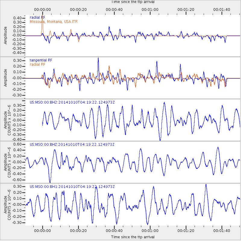
MSO Missoula, Montana, USA - Earthquake Result Viewer
*The percent match for this event was below the threshold and hence no stack was calculated.
| Earthquake location: |
Southern East Pacific Rise |
| Earthquake latitude/longitude: |
-32.2/-110.8 |
| Earthquake time(UTC): |
2014/10/10 (283) 04:07:51 GMT |
| Earthquake Depth: |
10 km |
| Earthquake Magnitude: |
5.5 MWP |
| Earthquake Catalog/Contributor: |
NEIC PDE/NEIC COMCAT |
|
| Network: |
US United States National Seismic Network |
| Station: |
MSO Missoula, Montana, USA |
| Lat/Lon: |
46.83 N/113.94 W |
| Elevation: |
1264 m |
|
| Distance: |
78.7 deg |
| Az: |
357.806 deg |
| Baz: |
177.291 deg |
| Ray Param: |
$rayparam |
*The percent match for this event was below the threshold and hence was not used in the summary stack. |
|
| Radial Match: |
42.675266 % |
| Radial Bump: |
400 |
| Transverse Match: |
59.75928 % |
| Transverse Bump: |
400 |
| SOD ConfigId: |
803114 |
| Insert Time: |
2014-10-24 04:55:39.426 +0000 |
| GWidth: |
2.5 |
| Max Bumps: |
400 |
| Tol: |
0.001 |
|
Signal To Noise
| Channel | StoN | STA | LTA |
| US:MSO:00:BHZ:20141010T04:19:22.124973Z | 1.9173722 | 2.9606258E-7 | 1.544106E-7 |
| US:MSO:00:BH1:20141010T04:19:22.124973Z | 1.95635 | 1.4708614E-7 | 7.518396E-8 |
| US:MSO:00:BH2:20141010T04:19:22.124973Z | 2.450867 | 2.3745164E-7 | 9.6884754E-8 |
| Arrivals |
| Ps | |
| PpPs | |
| PsPs/PpSs | |


