You are here: Home > Network List > TA - USArray Transportable Network (new EarthScope stations) Stations List
> Station L54A Sinclairville, NY, USA > Earthquake Result Viewer
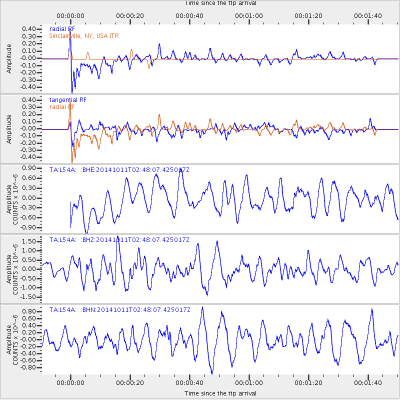
L54A Sinclairville, NY, USA - Earthquake Result Viewer
*The percent match for this event was below the threshold and hence no stack was calculated.
| Earthquake location: |
Off East Coast Of Honshu, Japan |
| Earthquake latitude/longitude: |
41.0/143.2 |
| Earthquake time(UTC): |
2014/10/11 (284) 02:35:46 GMT |
| Earthquake Depth: |
14 km |
| Earthquake Magnitude: |
6.3 MWP |
| Earthquake Catalog/Contributor: |
NEIC PDE/NEIC COMCAT |
|
| Network: |
TA USArray Transportable Network (new EarthScope stations) |
| Station: |
L54A Sinclairville, NY, USA |
| Lat/Lon: |
42.23 N/79.32 W |
| Elevation: |
432 m |
|
| Distance: |
88.7 deg |
| Az: |
30.143 deg |
| Baz: |
329.209 deg |
| Ray Param: |
$rayparam |
*The percent match for this event was below the threshold and hence was not used in the summary stack. |
|
| Radial Match: |
72.77966 % |
| Radial Bump: |
400 |
| Transverse Match: |
54.017395 % |
| Transverse Bump: |
400 |
| SOD ConfigId: |
803114 |
| Insert Time: |
2014-10-25 03:00:15.014 +0000 |
| GWidth: |
2.5 |
| Max Bumps: |
400 |
| Tol: |
0.001 |
|
Signal To Noise
| Channel | StoN | STA | LTA |
| TA:L54A: :BHZ:20141011T02:48:07.425017Z | 1.0023091 | 5.5411E-7 | 5.528334E-7 |
| TA:L54A: :BHN:20141011T02:48:07.425017Z | 0.38516295 | 2.0080708E-7 | 5.213561E-7 |
| TA:L54A: :BHE:20141011T02:48:07.425017Z | 1.1951516 | 5.020623E-7 | 4.2008253E-7 |
| Arrivals |
| Ps | |
| PpPs | |
| PsPs/PpSs | |


