You are here: Home > Network List > US - United States National Seismic Network Stations List
> Station ERPA Erie, Pennsylvania, USA > Earthquake Result Viewer
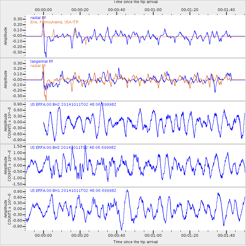
ERPA Erie, Pennsylvania, USA - Earthquake Result Viewer
*The percent match for this event was below the threshold and hence no stack was calculated.
| Earthquake location: |
Off East Coast Of Honshu, Japan |
| Earthquake latitude/longitude: |
41.0/143.2 |
| Earthquake time(UTC): |
2014/10/11 (284) 02:35:46 GMT |
| Earthquake Depth: |
14 km |
| Earthquake Magnitude: |
6.3 MWP |
| Earthquake Catalog/Contributor: |
NEIC PDE/NEIC COMCAT |
|
| Network: |
US United States National Seismic Network |
| Station: |
ERPA Erie, Pennsylvania, USA |
| Lat/Lon: |
42.12 N/79.99 W |
| Elevation: |
306 m |
|
| Distance: |
88.5 deg |
| Az: |
30.633 deg |
| Baz: |
328.771 deg |
| Ray Param: |
$rayparam |
*The percent match for this event was below the threshold and hence was not used in the summary stack. |
|
| Radial Match: |
63.330383 % |
| Radial Bump: |
400 |
| Transverse Match: |
64.68079 % |
| Transverse Bump: |
400 |
| SOD ConfigId: |
803114 |
| Insert Time: |
2014-10-25 03:03:28.400 +0000 |
| GWidth: |
2.5 |
| Max Bumps: |
400 |
| Tol: |
0.001 |
|
Signal To Noise
| Channel | StoN | STA | LTA |
| US:ERPA:00:BHZ:20141011T02:48:06.69998Z | 0.9224228 | 4.882706E-7 | 5.293349E-7 |
| US:ERPA:00:BH1:20141011T02:48:06.69998Z | 0.95206374 | 3.931901E-7 | 4.129872E-7 |
| US:ERPA:00:BH2:20141011T02:48:06.69998Z | 1.6082613 | 6.046236E-7 | 3.759486E-7 |
| Arrivals |
| Ps | |
| PpPs | |
| PsPs/PpSs | |


