
GRFO Grafenberg, Germany - Earthquake Result Viewer
| ||||||||||||||||||
| ||||||||||||||||||
| ||||||||||||||||||
|
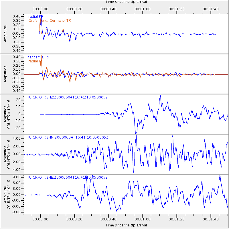
Signal To Noise
| Channel | StoN | STA | LTA |
| IU:GRFO: :BHN:20000604T16:41:10.050005Z | 0.5968626 | 7.860402E-8 | 1.3169533E-7 |
| IU:GRFO: :BHE:20000604T16:41:10.050005Z | 0.65329105 | 7.951519E-8 | 1.217148E-7 |
| IU:GRFO: :BHZ:20000604T16:41:10.050005Z | 1.0320631 | 1.397479E-7 | 1.3540634E-7 |
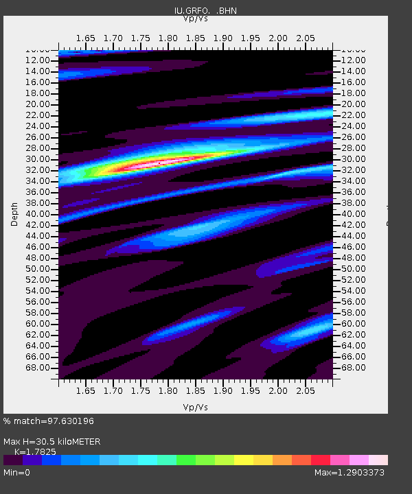
| Arrivals | |
| Ps | 3.9 SECOND |
| PpPs | 13 SECOND |
| PsPs/PpSs | 17 SECOND |

