You are here: Home > Network List > TA - USArray Transportable Network (new EarthScope stations) Stations List
> Station G59A Clarenceville, QC, USA > Earthquake Result Viewer
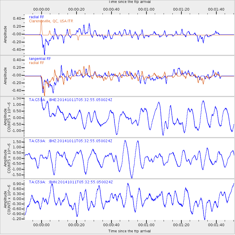
G59A Clarenceville, QC, USA - Earthquake Result Viewer
*The percent match for this event was below the threshold and hence no stack was calculated.
| Earthquake location: |
Near East Coast Of Honshu, Japan |
| Earthquake latitude/longitude: |
41.0/143.0 |
| Earthquake time(UTC): |
2014/10/11 (284) 05:20:37 GMT |
| Earthquake Depth: |
35 km |
| Earthquake Magnitude: |
5.5 MB |
| Earthquake Catalog/Contributor: |
NEIC PDE/NEIC COMCAT |
|
| Network: |
TA USArray Transportable Network (new EarthScope stations) |
| Station: |
G59A Clarenceville, QC, USA |
| Lat/Lon: |
45.08 N/73.18 W |
| Elevation: |
36 m |
|
| Distance: |
88.4 deg |
| Az: |
24.726 deg |
| Baz: |
333.444 deg |
| Ray Param: |
$rayparam |
*The percent match for this event was below the threshold and hence was not used in the summary stack. |
|
| Radial Match: |
56.897926 % |
| Radial Bump: |
400 |
| Transverse Match: |
49.81899 % |
| Transverse Bump: |
400 |
| SOD ConfigId: |
803114 |
| Insert Time: |
2014-10-25 05:56:09.315 +0000 |
| GWidth: |
2.5 |
| Max Bumps: |
400 |
| Tol: |
0.001 |
|
Signal To Noise
| Channel | StoN | STA | LTA |
| TA:G59A: :BHZ:20141011T05:32:55.050024Z | 0.67767406 | 3.0478577E-7 | 4.4975275E-7 |
| TA:G59A: :BHN:20141011T05:32:55.050024Z | 0.8257483 | 5.279371E-7 | 6.3934385E-7 |
| TA:G59A: :BHE:20141011T05:32:55.050024Z | 1.3481812 | 5.823286E-7 | 4.3193643E-7 |
| Arrivals |
| Ps | |
| PpPs | |
| PsPs/PpSs | |


