GRFO Grafenberg, Germany - Earthquake Result Viewer
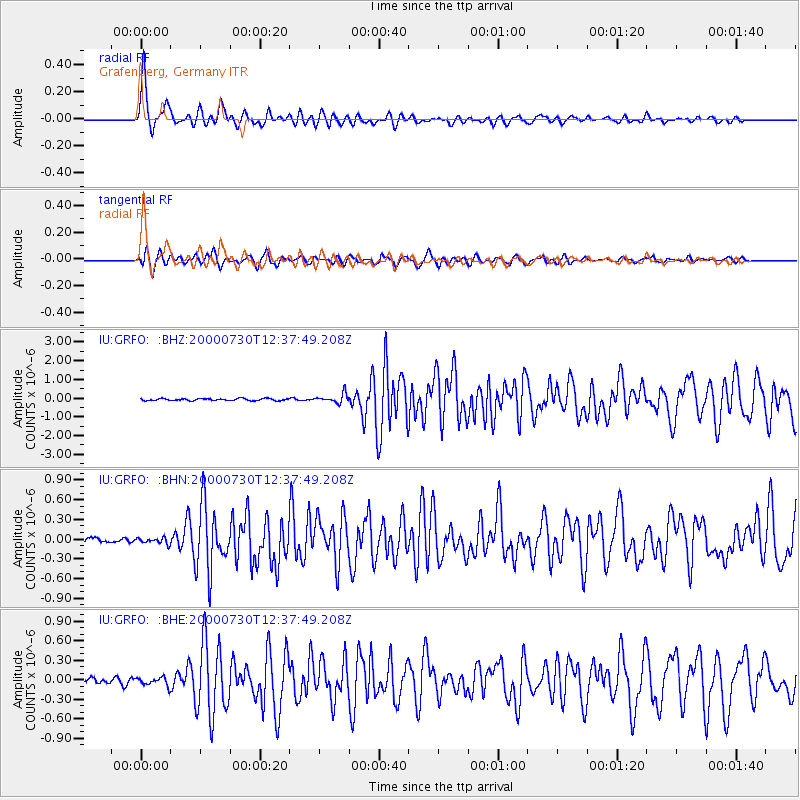
Earthquake location: Southeast Of Honshu, Japan
Earthquake latitude/longitude: 33.9/139.4
Earthquake time(UTC): 2000/07/30 (212) 12:25:45 GMT
Earthquake Depth: 10 km
Earthquake Magnitude: 6.0 MB, 6.5 MS, 6.5 MW, 6.5 MW
Earthquake Catalog/Contributor: WHDF/NEIC
Network: IU Global Seismograph Network (GSN - IRIS/USGS)
Station: GRFO Grafenberg, Germany
Lat/Lon: 49.69 N/11.22 E
Elevation: 425 m
Distance: 84.9 deg
Az: 329.157 deg
Baz: 41.042 deg
Ray Param: 0.045133993
Estimated Moho Depth: 24.25 km
Estimated Crust Vp/Vs: 2.10
Assumed Crust Vp: 6.182 km/s
Estimated Crust Vs: 2.951 km/s
Estimated Crust Poisson's Ratio: 0.35
Radial Match: 95.601425 %
Radial Bump: 400
Transverse Match: 88.3757 %
Transverse Bump: 400
SOD ConfigId: 3744
Insert Time: 2010-03-02 02:25:30.369 +0000
GWidth: 2.5
Max Bumps: 400
Tol: 0.001

Signal To Noise

ChannelStoNSTALTA
IU:GRFO: :BHN:20000730T12:37:49.208Z0.996222564.748383E-84.766388E-8
IU:GRFO: :BHE:20000730T12:37:49.208Z1.42478546.645712E-84.66436E-8
IU:GRFO: :BHZ:20000730T12:37:49.208Z4.3516832.386566E-75.4842367E-8
Arrivals
Ps4.4 SECOND
PpPs12 SECOND
PsPs/PpSs16 SECOND