
GRFO Grafenberg, Germany - Earthquake Result Viewer
| ||||||||||||||||||
| ||||||||||||||||||
| ||||||||||||||||||
|
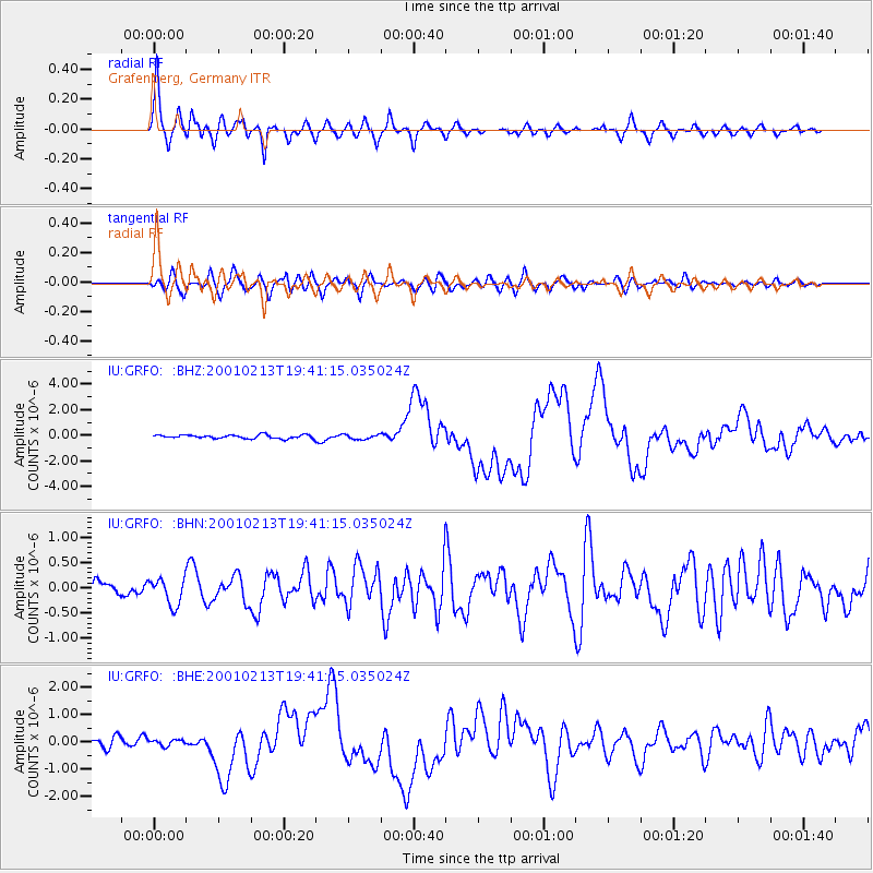
Signal To Noise
| Channel | StoN | STA | LTA |
| IU:GRFO: :BHN:20010213T19:41:15.035024Z | 1.8586956 | 2.6189235E-7 | 1.4090115E-7 |
| IU:GRFO: :BHE:20010213T19:41:15.035024Z | 0.7236499 | 1.1612763E-7 | 1.6047488E-7 |
| IU:GRFO: :BHZ:20010213T19:41:15.035024Z | 1.3939067 | 1.9221258E-7 | 1.3789486E-7 |
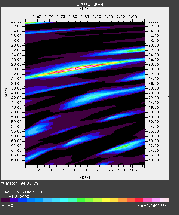
| Arrivals | |
| Ps | 3.9 SECOND |
| PpPs | 13 SECOND |
| PsPs/PpSs | 17 SECOND |

