You are here: Home > Network List > WY - Yellowstone Wyoming Seismic Network Stations List
> Station YHH Holmes Hill, YNP, WY, USA > Earthquake Result Viewer
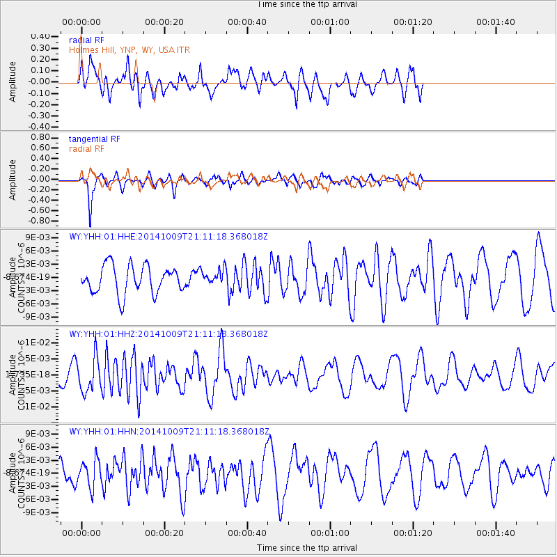
YHH Holmes Hill, YNP, WY, USA - Earthquake Result Viewer
*The percent match for this event was below the threshold and hence no stack was calculated.
| Earthquake location: |
Easter Island Region |
| Earthquake latitude/longitude: |
-32.0/-111.1 |
| Earthquake time(UTC): |
2014/10/09 (282) 21:00:00 GMT |
| Earthquake Depth: |
10 km |
| Earthquake Magnitude: |
5.7 MWW, 5.6 MWC |
| Earthquake Catalog/Contributor: |
NEIC PDE/NEIC COMCAT |
|
| Network: |
WY Yellowstone Wyoming Seismic Network |
| Station: |
YHH Holmes Hill, YNP, WY, USA |
| Lat/Lon: |
44.79 N/110.85 W |
| Elevation: |
2717 m |
|
| Distance: |
76.4 deg |
| Az: |
0.211 deg |
| Baz: |
180.251 deg |
| Ray Param: |
$rayparam |
*The percent match for this event was below the threshold and hence was not used in the summary stack. |
|
| Radial Match: |
46.792633 % |
| Radial Bump: |
400 |
| Transverse Match: |
76.23707 % |
| Transverse Bump: |
362 |
| SOD ConfigId: |
803114 |
| Insert Time: |
2014-10-27 00:06:30.331 +0000 |
| GWidth: |
2.5 |
| Max Bumps: |
400 |
| Tol: |
0.001 |
|
Signal To Noise
| Channel | StoN | STA | LTA |
| WY:YHH:01:HHZ:20141009T21:11:18.368018Z | 1.6730578 | 5.370381E-9 | 3.2099197E-9 |
| WY:YHH:01:HHN:20141009T21:11:18.368018Z | 1.007762 | 3.1889151E-9 | 3.1643534E-9 |
| WY:YHH:01:HHE:20141009T21:11:18.368018Z | 0.53211623 | 1.6898729E-9 | 3.175759E-9 |
| Arrivals |
| Ps | |
| PpPs | |
| PsPs/PpSs | |


