You are here: Home > Network List > UW - Pacific Northwest Regional Seismic Network Stations List
> Station PASS Maple Falls, WA, USA > Earthquake Result Viewer
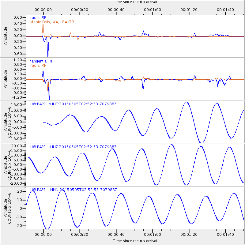
PASS Maple Falls, WA, USA - Earthquake Result Viewer
*The percent match for this event was below the threshold and hence no stack was calculated.
| Earthquake location: |
New Britain Region, P.N.G. |
| Earthquake latitude/longitude: |
-5.4/152.1 |
| Earthquake time(UTC): |
2015/05/05 (125) 02:40:24 GMT |
| Earthquake Depth: |
45 km |
| Earthquake Magnitude: |
5.3 mb |
| Earthquake Catalog/Contributor: |
ISC/ISC |
|
| Network: |
UW Pacific Northwest Regional Seismic Network |
| Station: |
PASS Maple Falls, WA, USA |
| Lat/Lon: |
49.00 N/122.09 W |
| Elevation: |
174 m |
|
| Distance: |
91.3 deg |
| Az: |
41.072 deg |
| Baz: |
263.333 deg |
| Ray Param: |
$rayparam |
*The percent match for this event was below the threshold and hence was not used in the summary stack. |
|
| Radial Match: |
83.15875 % |
| Radial Bump: |
365 |
| Transverse Match: |
82.92389 % |
| Transverse Bump: |
346 |
| SOD ConfigId: |
7422571 |
| Insert Time: |
2019-04-18 16:28:18.222 +0000 |
| GWidth: |
2.5 |
| Max Bumps: |
400 |
| Tol: |
0.001 |
|
Signal To Noise
| Channel | StoN | STA | LTA |
| UW:PASS: :HHZ:20150505T02:52:53.707988Z | 1.0346023 | 5.725992E-6 | 5.5344863E-6 |
| UW:PASS: :HHN:20150505T02:52:53.707988Z | 1.540684 | 1.9901605E-5 | 1.2917382E-5 |
| UW:PASS: :HHE:20150505T02:52:53.707988Z | 1.0442361 | 4.515369E-6 | 4.324088E-6 |
| Arrivals |
| Ps | |
| PpPs | |
| PsPs/PpSs | |


