You are here: Home > Network List > IU - Global Seismograph Network (GSN - IRIS/USGS) Stations List
> Station GRFO Grafenberg, Germany > Earthquake Result Viewer
GRFO Grafenberg, Germany - Earthquake Result Viewer
*The percent match for this event was below the threshold and hence no stack was calculated.
| Earthquake location: |
Central Mid-Atlantic Ridge |
| Earthquake latitude/longitude: |
0.9/-29.0 |
| Earthquake time(UTC): |
2008/09/16 (260) 07:28:25 GMT |
| Earthquake Depth: |
10 km |
| Earthquake Magnitude: |
5.8 MW, 5.2 MS, 5.2 MB, 5.8 MW |
| Earthquake Catalog/Contributor: |
WHDF/NEIC |
|
| Network: |
IU Global Seismograph Network (GSN - IRIS/USGS) |
| Station: |
GRFO Grafenberg, Germany |
| Lat/Lon: |
49.69 N/11.22 E |
| Elevation: |
384 m |
|
| Distance: |
59.5 deg |
| Az: |
29.127 deg |
| Baz: |
228.539 deg |
| Ray Param: |
$rayparam |
*The percent match for this event was below the threshold and hence was not used in the summary stack. |
|
| Radial Match: |
65.58119 % |
| Radial Bump: |
400 |
| Transverse Match: |
71.60643 % |
| Transverse Bump: |
400 |
| SOD ConfigId: |
2504 |
| Insert Time: |
2010-03-02 02:29:34.595 +0000 |
| GWidth: |
2.5 |
| Max Bumps: |
400 |
| Tol: |
0.001 |
|
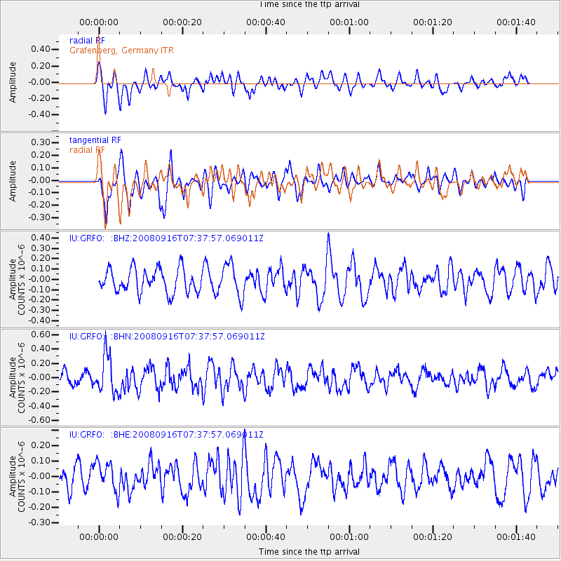
Signal To Noise
| Channel | StoN | STA | LTA |
| IU:GRFO: :BHN:20080916T07:37:57.069011Z | 3.0575042 | 2.7304165E-7 | 8.9302134E-8 |
| IU:GRFO: :BHE:20080916T07:37:57.069011Z | 0.96316123 | 9.447534E-8 | 9.808881E-8 |
| IU:GRFO: :BHZ:20080916T07:37:57.069011Z | 1.4300388 | 1.6090604E-7 | 1.12518656E-7 |
| Arrivals |
| Ps | |
| PpPs | |
| PsPs/PpSs | |


