You are here: Home > Network List > IU - Global Seismograph Network (GSN - IRIS/USGS) Stations List
> Station GRFO Grafenberg, Germany > Earthquake Result Viewer
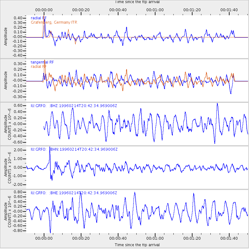
GRFO Grafenberg, Germany - Earthquake Result Viewer
*The percent match for this event was below the threshold and hence no stack was calculated.
| Earthquake location: |
Kuril Islands |
| Earthquake latitude/longitude: |
45.4/150.4 |
| Earthquake time(UTC): |
1996/02/14 (045) 20:31:06 GMT |
| Earthquake Depth: |
33 km |
| Earthquake Magnitude: |
5.9 MB, 5.2 MS, 5.8 UNKNOWN, 5.8 MW |
| Earthquake Catalog/Contributor: |
WHDF/NEIC |
|
| Network: |
IU Global Seismograph Network (GSN - IRIS/USGS) |
| Station: |
GRFO Grafenberg, Germany |
| Lat/Lon: |
49.69 N/11.22 E |
| Elevation: |
425 m |
|
| Distance: |
78.8 deg |
| Az: |
334.339 deg |
| Baz: |
28.029 deg |
| Ray Param: |
$rayparam |
*The percent match for this event was below the threshold and hence was not used in the summary stack. |
|
| Radial Match: |
60.092445 % |
| Radial Bump: |
400 |
| Transverse Match: |
49.328075 % |
| Transverse Bump: |
382 |
| SOD ConfigId: |
4480 |
| Insert Time: |
2010-03-02 02:30:35.819 +0000 |
| GWidth: |
2.5 |
| Max Bumps: |
400 |
| Tol: |
0.001 |
|
Signal To Noise
| Channel | StoN | STA | LTA |
| IU:GRFO: :BHN:19960214T20:42:34.969006Z | 5.669567 | 8.2329365E-7 | 1.452128E-7 |
| IU:GRFO: :BHE:19960214T20:42:34.969006Z | 0.9549134 | 2.9782194E-7 | 3.1188372E-7 |
| IU:GRFO: :BHZ:19960214T20:42:34.969006Z | 1.0838033 | 2.5686447E-7 | 2.3700287E-7 |
| Arrivals |
| Ps | |
| PpPs | |
| PsPs/PpSs | |


