You are here: Home > Network List > IU - Global Seismograph Network (GSN - IRIS/USGS) Stations List
> Station GRFO Grafenberg, Germany > Earthquake Result Viewer
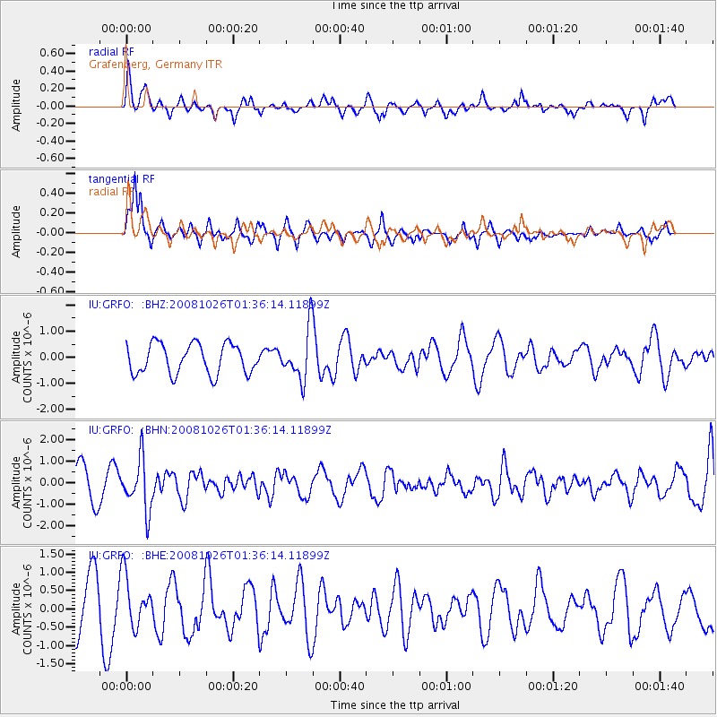
GRFO Grafenberg, Germany - Earthquake Result Viewer
*The percent match for this event was below the threshold and hence no stack was calculated.
| Earthquake location: |
Hindu Kush Region, Afghanistan |
| Earthquake latitude/longitude: |
36.5/70.7 |
| Earthquake time(UTC): |
2008/10/26 (300) 01:28:56 GMT |
| Earthquake Depth: |
210 km |
| Earthquake Magnitude: |
5.5 MB, 5.7 MW, 5.7 MW |
| Earthquake Catalog/Contributor: |
WHDF/NEIC |
|
| Network: |
IU Global Seismograph Network (GSN - IRIS/USGS) |
| Station: |
GRFO Grafenberg, Germany |
| Lat/Lon: |
49.69 N/11.22 E |
| Elevation: |
384 m |
|
| Distance: |
44.3 deg |
| Az: |
306.732 deg |
| Baz: |
83.982 deg |
| Ray Param: |
$rayparam |
*The percent match for this event was below the threshold and hence was not used in the summary stack. |
|
| Radial Match: |
65.28506 % |
| Radial Bump: |
400 |
| Transverse Match: |
64.60187 % |
| Transverse Bump: |
368 |
| SOD ConfigId: |
2560 |
| Insert Time: |
2010-03-02 02:31:54.717 +0000 |
| GWidth: |
2.5 |
| Max Bumps: |
400 |
| Tol: |
0.001 |
|
Signal To Noise
| Channel | StoN | STA | LTA |
| IU:GRFO: :BHN:20081026T01:36:14.11899Z | 1.7647533 | 1.1953508E-6 | 6.773472E-7 |
| IU:GRFO: :BHE:20081026T01:36:14.11899Z | 1.1430315 | 6.8237813E-7 | 5.9698976E-7 |
| IU:GRFO: :BHZ:20081026T01:36:14.11899Z | 1.7113758 | 9.780374E-7 | 5.714919E-7 |
| Arrivals |
| Ps | |
| PpPs | |
| PsPs/PpSs | |


