You are here: Home > Network List > IU - Global Seismograph Network (GSN - IRIS/USGS) Stations List
> Station GRFO Grafenberg, Germany > Earthquake Result Viewer
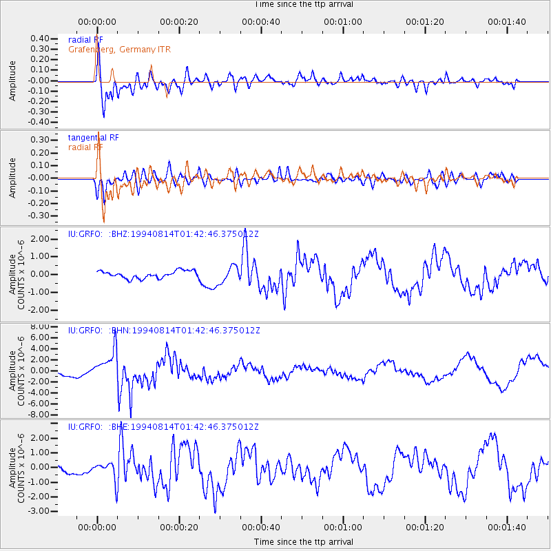
GRFO Grafenberg, Germany - Earthquake Result Viewer
*The percent match for this event was below the threshold and hence no stack was calculated.
| Earthquake location: |
East Of Kuril Islands |
| Earthquake latitude/longitude: |
44.7/150.0 |
| Earthquake time(UTC): |
1994/08/14 (226) 01:31:14 GMT |
| Earthquake Depth: |
33 km |
| Earthquake Magnitude: |
6.1 MB, 6.0 MS, 5.6 UNKNOWN, 6.5 MW |
| Earthquake Catalog/Contributor: |
WHDF/NEIC |
|
| Network: |
IU Global Seismograph Network (GSN - IRIS/USGS) |
| Station: |
GRFO Grafenberg, Germany |
| Lat/Lon: |
49.69 N/11.22 E |
| Elevation: |
425 m |
|
| Distance: |
79.4 deg |
| Az: |
334.193 deg |
| Baz: |
28.57 deg |
| Ray Param: |
$rayparam |
*The percent match for this event was below the threshold and hence was not used in the summary stack. |
|
| Radial Match: |
69.259186 % |
| Radial Bump: |
400 |
| Transverse Match: |
69.55366 % |
| Transverse Bump: |
400 |
| SOD ConfigId: |
4480 |
| Insert Time: |
2010-03-02 02:32:10.413 +0000 |
| GWidth: |
2.5 |
| Max Bumps: |
400 |
| Tol: |
0.001 |
|
Signal To Noise
| Channel | StoN | STA | LTA |
| IU:GRFO: :BHN:19940814T01:42:46.375012Z | 4.809565 | 2.963968E-6 | 6.162653E-7 |
| IU:GRFO: :BHE:19940814T01:42:46.375012Z | 2.203959 | 6.7199477E-7 | 3.0490347E-7 |
| IU:GRFO: :BHZ:19940814T01:42:46.375012Z | 2.2766867 | 4.6899856E-7 | 2.060005E-7 |
| Arrivals |
| Ps | |
| PpPs | |
| PsPs/PpSs | |


