You are here: Home > Network List > IU - Global Seismograph Network (GSN - IRIS/USGS) Stations List
> Station GRFO Grafenberg, Germany > Earthquake Result Viewer
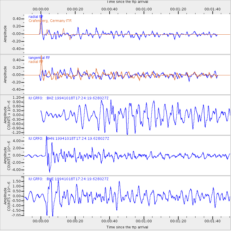
GRFO Grafenberg, Germany - Earthquake Result Viewer
*The percent match for this event was below the threshold and hence no stack was calculated.
| Earthquake location: |
Kuril Islands |
| Earthquake latitude/longitude: |
43.6/147.1 |
| Earthquake time(UTC): |
1994/10/18 (291) 17:12:51 GMT |
| Earthquake Depth: |
66 km |
| Earthquake Magnitude: |
6.1 MB, 6.1 UNKNOWN, 5.9 MW |
| Earthquake Catalog/Contributor: |
WHDF/NEIC |
|
| Network: |
IU Global Seismograph Network (GSN - IRIS/USGS) |
| Station: |
GRFO Grafenberg, Germany |
| Lat/Lon: |
49.69 N/11.22 E |
| Elevation: |
425 m |
|
| Distance: |
79.5 deg |
| Az: |
332.633 deg |
| Baz: |
30.973 deg |
| Ray Param: |
$rayparam |
*The percent match for this event was below the threshold and hence was not used in the summary stack. |
|
| Radial Match: |
76.03253 % |
| Radial Bump: |
387 |
| Transverse Match: |
74.73413 % |
| Transverse Bump: |
400 |
| SOD ConfigId: |
4480 |
| Insert Time: |
2010-03-02 02:33:45.047 +0000 |
| GWidth: |
2.5 |
| Max Bumps: |
400 |
| Tol: |
0.001 |
|
Signal To Noise
| Channel | StoN | STA | LTA |
| IU:GRFO: :BHN:19941018T17:24:19.628027Z | 6.9660587 | 1.6534736E-6 | 2.3736143E-7 |
| IU:GRFO: :BHE:19941018T17:24:19.628027Z | 2.6795087 | 7.170024E-7 | 2.6758727E-7 |
| IU:GRFO: :BHZ:19941018T17:24:19.628027Z | 1.3362483 | 3.807501E-7 | 2.8493966E-7 |
| Arrivals |
| Ps | |
| PpPs | |
| PsPs/PpSs | |


