You are here: Home > Network List > G - GEOSCOPE Stations List
> Station UNM Unam,Mexico > Earthquake Result Viewer
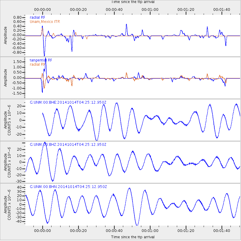
UNM Unam,Mexico - Earthquake Result Viewer
*The percent match for this event was below the threshold and hence no stack was calculated.
| Earthquake location: |
South Of Kermadec Islands |
| Earthquake latitude/longitude: |
-34.9/180.0 |
| Earthquake time(UTC): |
2014/10/14 (287) 04:12:30 GMT |
| Earthquake Depth: |
32 km |
| Earthquake Magnitude: |
6.1 MB |
| Earthquake Catalog/Contributor: |
NEIC PDE/NEIC COMCAT |
|
| Network: |
G GEOSCOPE |
| Station: |
UNM Unam,Mexico |
| Lat/Lon: |
19.33 N/99.18 W |
| Elevation: |
2280 m |
|
| Distance: |
93.7 deg |
| Az: |
69.105 deg |
| Baz: |
234.39 deg |
| Ray Param: |
$rayparam |
*The percent match for this event was below the threshold and hence was not used in the summary stack. |
|
| Radial Match: |
72.0059 % |
| Radial Bump: |
340 |
| Transverse Match: |
81.57227 % |
| Transverse Bump: |
377 |
| SOD ConfigId: |
803114 |
| Insert Time: |
2014-10-28 04:46:02.339 +0000 |
| GWidth: |
2.5 |
| Max Bumps: |
400 |
| Tol: |
0.001 |
|
Signal To Noise
| Channel | StoN | STA | LTA |
| G:UNM:00:BHZ:20141014T04:25:12.950Z | 1.9937929 | 2.1404252E-5 | 1.07354435E-5 |
| G:UNM:00:BHN:20141014T04:25:12.950Z | 1.7051555 | 2.7834158E-5 | 1.632353E-5 |
| G:UNM:00:BHE:20141014T04:25:12.950Z | 1.744687 | 2.0169E-5 | 1.156024E-5 |
| Arrivals |
| Ps | |
| PpPs | |
| PsPs/PpSs | |


