You are here: Home > Network List > UW - Pacific Northwest Regional Seismic Network Stations List
> Station HOOD Mt Hood Meadows, OR CREST BB SMO > Earthquake Result Viewer
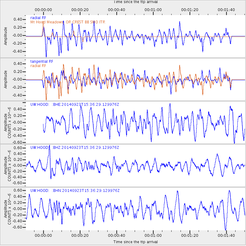
HOOD Mt Hood Meadows, OR CREST BB SMO - Earthquake Result Viewer
*The percent match for this event was below the threshold and hence no stack was calculated.
| Earthquake location: |
New Britain Region, P.N.G. |
| Earthquake latitude/longitude: |
-5.4/151.7 |
| Earthquake time(UTC): |
2014/09/23 (266) 15:24:00 GMT |
| Earthquake Depth: |
57 km |
| Earthquake Magnitude: |
5.5 MWC, 3.2 ML, 3.3 ML, 3.3 ML, 5.5 MWC |
| Earthquake Catalog/Contributor: |
NEIC PDE/NEIC COMCAT |
|
| Network: |
UW Pacific Northwest Regional Seismic Network |
| Station: |
HOOD Mt Hood Meadows, OR CREST BB SMO |
| Lat/Lon: |
45.32 N/121.65 W |
| Elevation: |
1520 m |
|
| Distance: |
91.4 deg |
| Az: |
44.788 deg |
| Baz: |
263.82 deg |
| Ray Param: |
$rayparam |
*The percent match for this event was below the threshold and hence was not used in the summary stack. |
|
| Radial Match: |
65.22036 % |
| Radial Bump: |
400 |
| Transverse Match: |
47.00318 % |
| Transverse Bump: |
400 |
| SOD ConfigId: |
803114 |
| Insert Time: |
2014-10-28 18:02:57.377 +0000 |
| GWidth: |
2.5 |
| Max Bumps: |
400 |
| Tol: |
0.001 |
|
Signal To Noise
| Channel | StoN | STA | LTA |
| UW:HOOD: :BHZ:20140923T15:36:29.129976Z | 4.207809 | 2.8426408E-7 | 6.7556314E-8 |
| UW:HOOD: :BHN:20140923T15:36:29.129976Z | 1.109112 | 1.9263149E-7 | 1.7368083E-7 |
| UW:HOOD: :BHE:20140923T15:36:29.129976Z | 0.9968628 | 2.0839744E-7 | 2.0905328E-7 |
| Arrivals |
| Ps | |
| PpPs | |
| PsPs/PpSs | |


