You are here: Home > Network List > TA - USArray Transportable Network (new EarthScope stations) Stations List
> Station L53A Girard, PA, USA > Earthquake Result Viewer
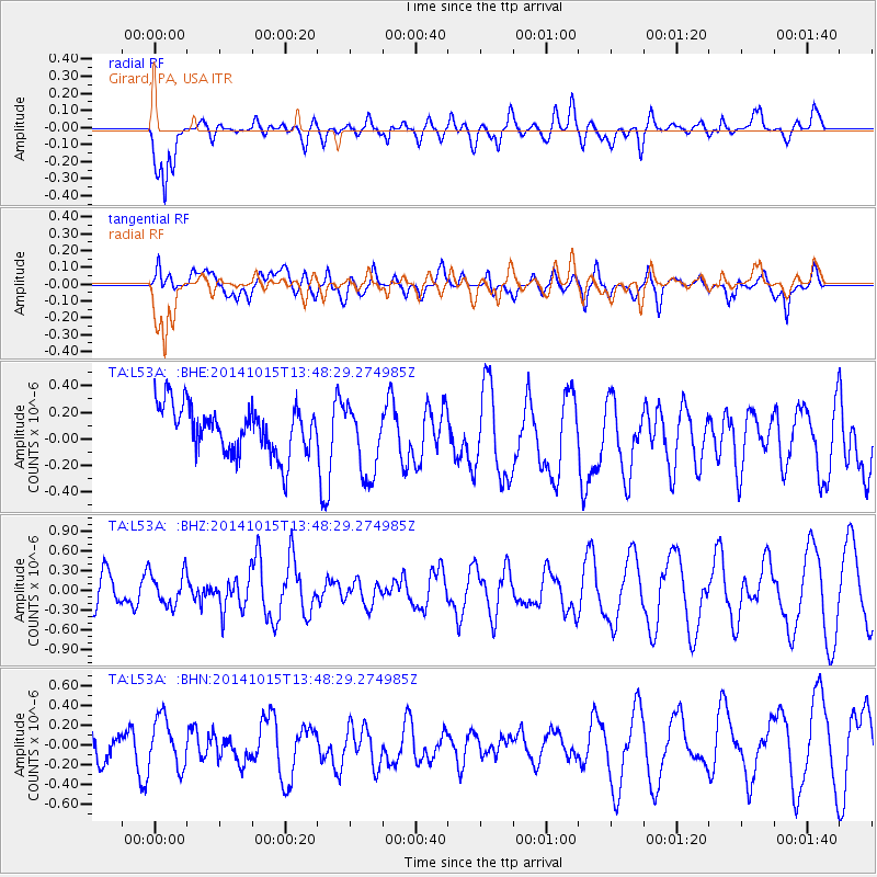
L53A Girard, PA, USA - Earthquake Result Viewer
*The percent match for this event was below the threshold and hence no stack was calculated.
| Earthquake location: |
Iran-Iraq Border Region |
| Earthquake latitude/longitude: |
32.5/47.8 |
| Earthquake time(UTC): |
2014/10/15 (288) 13:35:52 GMT |
| Earthquake Depth: |
10 km |
| Earthquake Magnitude: |
5.5 MB, 5.6 MWB |
| Earthquake Catalog/Contributor: |
NEIC PDE/NEIC COMCAT |
|
| Network: |
TA USArray Transportable Network (new EarthScope stations) |
| Station: |
L53A Girard, PA, USA |
| Lat/Lon: |
41.95 N/80.26 W |
| Elevation: |
355 m |
|
| Distance: |
91.8 deg |
| Az: |
324.002 deg |
| Baz: |
41.736 deg |
| Ray Param: |
$rayparam |
*The percent match for this event was below the threshold and hence was not used in the summary stack. |
|
| Radial Match: |
78.172 % |
| Radial Bump: |
400 |
| Transverse Match: |
43.542492 % |
| Transverse Bump: |
400 |
| SOD ConfigId: |
803114 |
| Insert Time: |
2014-10-29 14:05:17.379 +0000 |
| GWidth: |
2.5 |
| Max Bumps: |
400 |
| Tol: |
0.001 |
|
Signal To Noise
| Channel | StoN | STA | LTA |
| TA:L53A: :BHZ:20141015T13:48:29.274985Z | 0.8311874 | 2.496557E-7 | 3.0036028E-7 |
| TA:L53A: :BHN:20141015T13:48:29.274985Z | 1.2402593 | 2.550489E-7 | 2.0564157E-7 |
| TA:L53A: :BHE:20141015T13:48:29.274985Z | 1.5020726 | 2.6939423E-7 | 1.7934833E-7 |
| Arrivals |
| Ps | |
| PpPs | |
| PsPs/PpSs | |


