You are here: Home > Network List > TA - USArray Transportable Network (new EarthScope stations) Stations List
> Station Q56A Snyder Ridge, Maysville, WV, USA > Earthquake Result Viewer
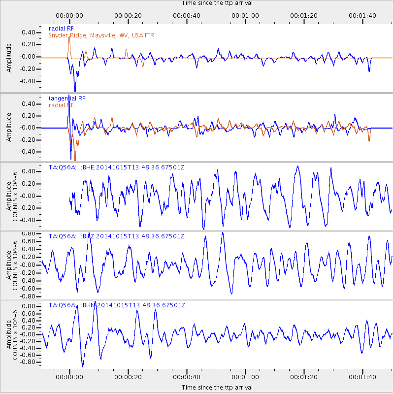
Q56A Snyder Ridge, Maysville, WV, USA - Earthquake Result Viewer
*The percent match for this event was below the threshold and hence no stack was calculated.
| Earthquake location: |
Iran-Iraq Border Region |
| Earthquake latitude/longitude: |
32.5/47.8 |
| Earthquake time(UTC): |
2014/10/15 (288) 13:35:52 GMT |
| Earthquake Depth: |
10 km |
| Earthquake Magnitude: |
5.5 MB, 5.6 MWB |
| Earthquake Catalog/Contributor: |
NEIC PDE/NEIC COMCAT |
|
| Network: |
TA USArray Transportable Network (new EarthScope stations) |
| Station: |
Q56A Snyder Ridge, Maysville, WV, USA |
| Lat/Lon: |
39.04 N/79.19 W |
| Elevation: |
430 m |
|
| Distance: |
93.4 deg |
| Az: |
321.441 deg |
| Baz: |
42.548 deg |
| Ray Param: |
$rayparam |
*The percent match for this event was below the threshold and hence was not used in the summary stack. |
|
| Radial Match: |
65.94771 % |
| Radial Bump: |
400 |
| Transverse Match: |
50.24706 % |
| Transverse Bump: |
400 |
| SOD ConfigId: |
803114 |
| Insert Time: |
2014-10-29 14:07:01.432 +0000 |
| GWidth: |
2.5 |
| Max Bumps: |
400 |
| Tol: |
0.001 |
|
Signal To Noise
| Channel | StoN | STA | LTA |
| TA:Q56A: :BHZ:20141015T13:48:36.67501Z | 1.7434101 | 3.4646703E-7 | 1.9872951E-7 |
| TA:Q56A: :BHN:20141015T13:48:36.67501Z | 2.9347546 | 5.042211E-7 | 1.718103E-7 |
| TA:Q56A: :BHE:20141015T13:48:36.67501Z | 0.88693607 | 1.7103692E-7 | 1.9284019E-7 |
| Arrivals |
| Ps | |
| PpPs | |
| PsPs/PpSs | |


