You are here: Home > Network List > TA - USArray Transportable Network (new EarthScope stations) Stations List
> Station W57A Gilead, NC, USA > Earthquake Result Viewer
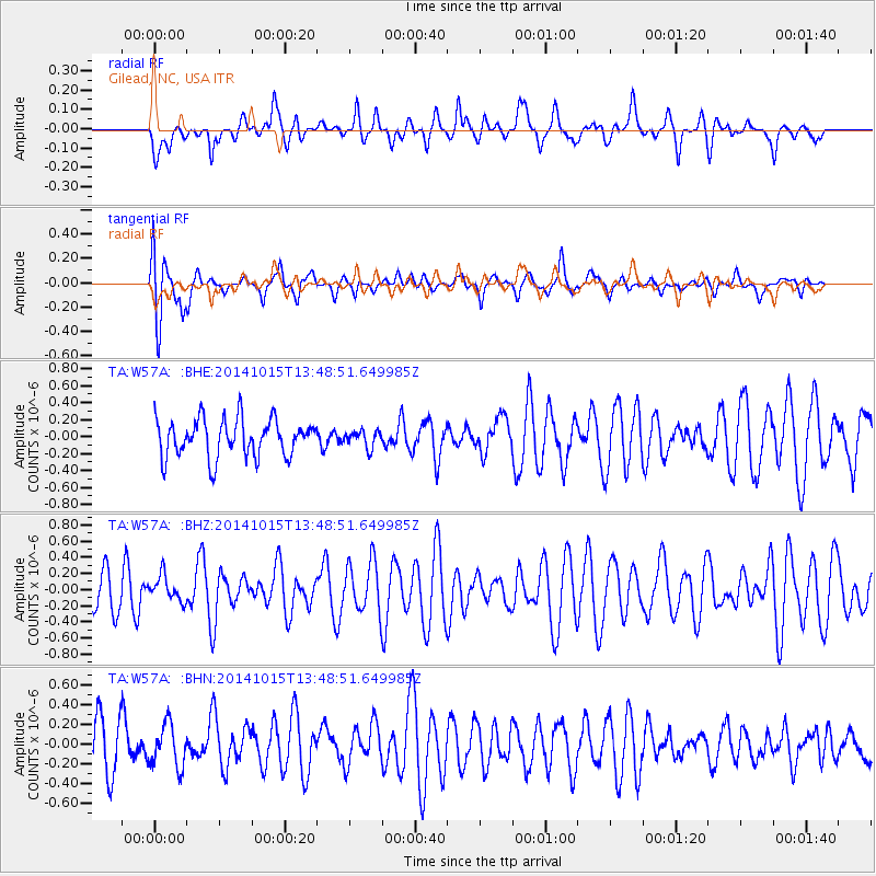
W57A Gilead, NC, USA - Earthquake Result Viewer
*The percent match for this event was below the threshold and hence no stack was calculated.
| Earthquake location: |
Iran-Iraq Border Region |
| Earthquake latitude/longitude: |
32.5/47.8 |
| Earthquake time(UTC): |
2014/10/15 (288) 13:35:52 GMT |
| Earthquake Depth: |
10 km |
| Earthquake Magnitude: |
5.5 MB, 5.6 MWB |
| Earthquake Catalog/Contributor: |
NEIC PDE/NEIC COMCAT |
|
| Network: |
TA USArray Transportable Network (new EarthScope stations) |
| Station: |
W57A Gilead, NC, USA |
| Lat/Lon: |
35.15 N/79.99 W |
| Elevation: |
85 m |
|
| Distance: |
96.7 deg |
| Az: |
319.291 deg |
| Baz: |
42.255 deg |
| Ray Param: |
$rayparam |
*The percent match for this event was below the threshold and hence was not used in the summary stack. |
|
| Radial Match: |
62.48862 % |
| Radial Bump: |
400 |
| Transverse Match: |
70.74934 % |
| Transverse Bump: |
400 |
| SOD ConfigId: |
803114 |
| Insert Time: |
2014-10-29 14:08:24.015 +0000 |
| GWidth: |
2.5 |
| Max Bumps: |
400 |
| Tol: |
0.001 |
|
Signal To Noise
| Channel | StoN | STA | LTA |
| TA:W57A: :BHZ:20141015T13:48:51.649985Z | 0.59374946 | 1.6091501E-7 | 2.7101498E-7 |
| TA:W57A: :BHN:20141015T13:48:51.649985Z | 1.0078992 | 2.1739045E-7 | 2.1568671E-7 |
| TA:W57A: :BHE:20141015T13:48:51.649985Z | 0.44597948 | 9.91287E-8 | 2.2227188E-7 |
| Arrivals |
| Ps | |
| PpPs | |
| PsPs/PpSs | |


