You are here: Home > Network List > TA - USArray Transportable Network (new EarthScope stations) Stations List
> Station 833A Chaparral WMA, Artesia Wells, TX, USA > Earthquake Result Viewer
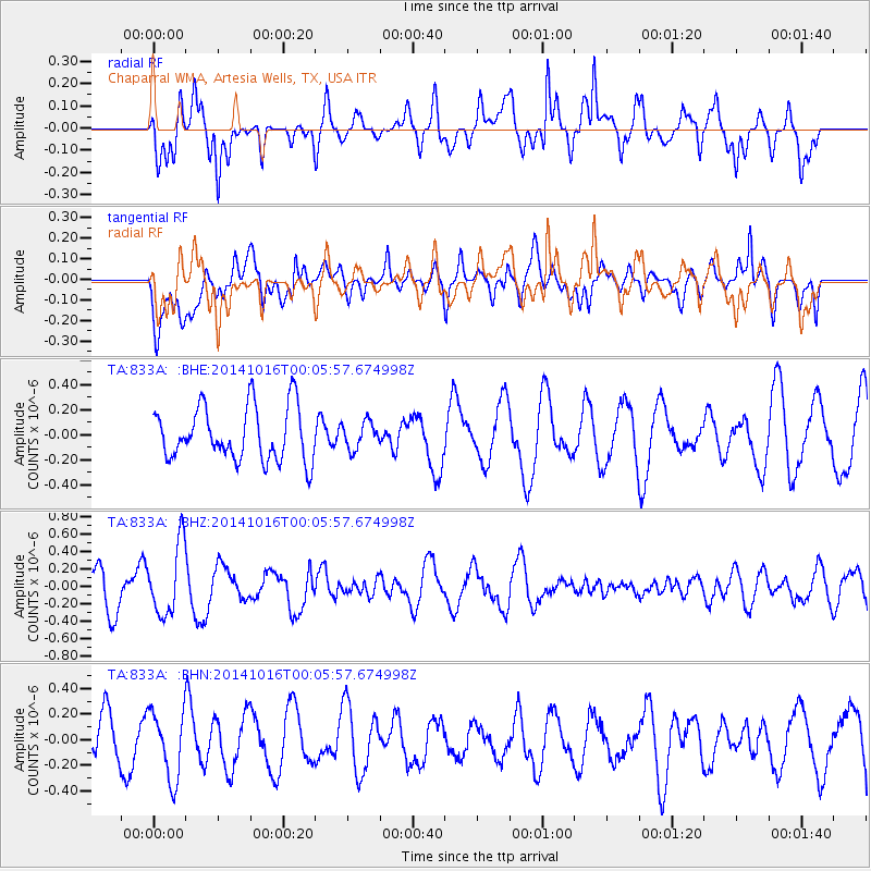
833A Chaparral WMA, Artesia Wells, TX, USA - Earthquake Result Viewer
*The percent match for this event was below the threshold and hence no stack was calculated.
| Earthquake location: |
Southeast Of Honshu, Japan |
| Earthquake latitude/longitude: |
31.7/140.5 |
| Earthquake time(UTC): |
2014/10/15 (288) 23:53:01 GMT |
| Earthquake Depth: |
58 km |
| Earthquake Magnitude: |
5.5 MWW, 5.5 MWC, 5.6 MWB |
| Earthquake Catalog/Contributor: |
NEIC PDE/NEIC COMCAT |
|
| Network: |
TA USArray Transportable Network (new EarthScope stations) |
| Station: |
833A Chaparral WMA, Artesia Wells, TX, USA |
| Lat/Lon: |
28.32 N/99.39 W |
| Elevation: |
171 m |
|
| Distance: |
97.4 deg |
| Az: |
50.288 deg |
| Baz: |
311.979 deg |
| Ray Param: |
$rayparam |
*The percent match for this event was below the threshold and hence was not used in the summary stack. |
|
| Radial Match: |
68.75642 % |
| Radial Bump: |
400 |
| Transverse Match: |
60.283783 % |
| Transverse Bump: |
400 |
| SOD ConfigId: |
803114 |
| Insert Time: |
2014-10-30 00:28:40.093 +0000 |
| GWidth: |
2.5 |
| Max Bumps: |
400 |
| Tol: |
0.001 |
|
Signal To Noise
| Channel | StoN | STA | LTA |
| TA:833A: :BHZ:20141016T00:05:57.674998Z | 2.3540366 | 4.033761E-7 | 1.7135508E-7 |
| TA:833A: :BHN:20141016T00:05:57.674998Z | 1.5318576 | 2.6480848E-7 | 1.7286756E-7 |
| TA:833A: :BHE:20141016T00:05:57.674998Z | 0.5012596 | 1.0767701E-7 | 2.1481286E-7 |
| Arrivals |
| Ps | |
| PpPs | |
| PsPs/PpSs | |


