You are here: Home > Network List > IU - Global Seismograph Network (GSN - IRIS/USGS) Stations List
> Station GRFO Grafenberg, Germany > Earthquake Result Viewer
GRFO Grafenberg, Germany - Earthquake Result Viewer
*The percent match for this event was below the threshold and hence no stack was calculated.
| Earthquake location: |
Hokkaido, Japan Region |
| Earthquake latitude/longitude: |
41.9/144.8 |
| Earthquake time(UTC): |
1997/10/08 (281) 21:20:59 GMT |
| Earthquake Depth: |
33 km |
| Earthquake Magnitude: |
5.5 MB, 5.6 MS, 5.9 UNKNOWN, 5.9 MW |
| Earthquake Catalog/Contributor: |
WHDF/NEIC |
|
| Network: |
IU Global Seismograph Network (GSN - IRIS/USGS) |
| Station: |
GRFO Grafenberg, Germany |
| Lat/Lon: |
49.69 N/11.22 E |
| Elevation: |
425 m |
|
| Distance: |
80.1 deg |
| Az: |
331.481 deg |
| Baz: |
33.281 deg |
| Ray Param: |
$rayparam |
*The percent match for this event was below the threshold and hence was not used in the summary stack. |
|
| Radial Match: |
63.238625 % |
| Radial Bump: |
398 |
| Transverse Match: |
59.44085 % |
| Transverse Bump: |
400 |
| SOD ConfigId: |
4480 |
| Insert Time: |
2010-03-02 02:39:44.831 +0000 |
| GWidth: |
2.5 |
| Max Bumps: |
400 |
| Tol: |
0.001 |
|
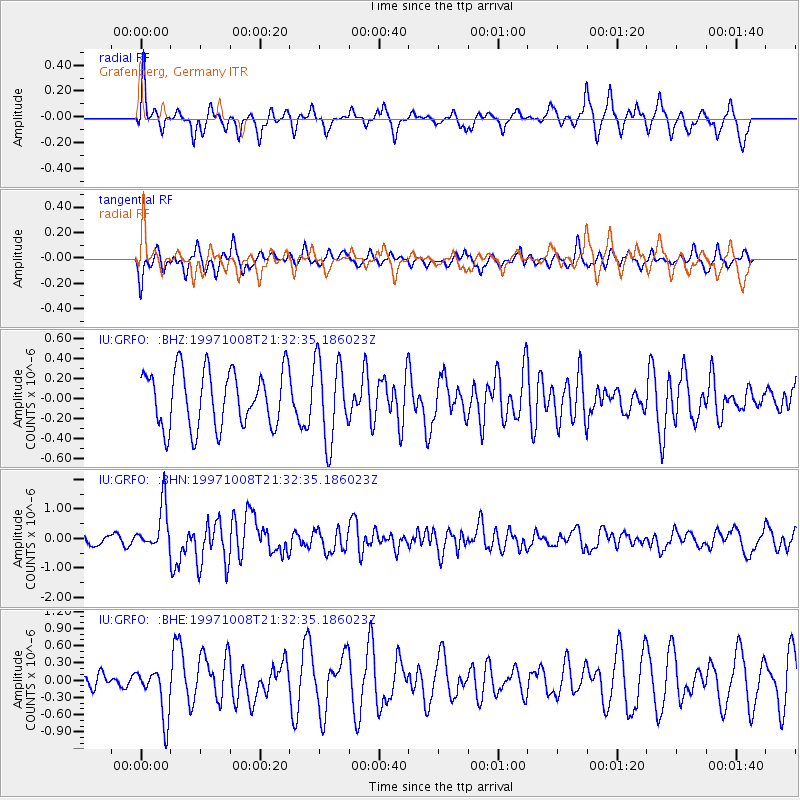
Signal To Noise
| Channel | StoN | STA | LTA |
| IU:GRFO: :BHN:19971008T21:32:35.186023Z | 5.258366 | 7.5233515E-7 | 1.4307395E-7 |
| IU:GRFO: :BHE:19971008T21:32:35.186023Z | 2.1214604 | 4.3685233E-7 | 2.0592057E-7 |
| IU:GRFO: :BHZ:19971008T21:32:35.186023Z | 1.4327228 | 4.0782658E-7 | 2.846514E-7 |
| Arrivals |
| Ps | |
| PpPs | |
| PsPs/PpSs | |


