
HKT Hockley, Texas - Earthquake Result Viewer
| ||||||||||||||||||
| ||||||||||||||||||
| ||||||||||||||||||
|
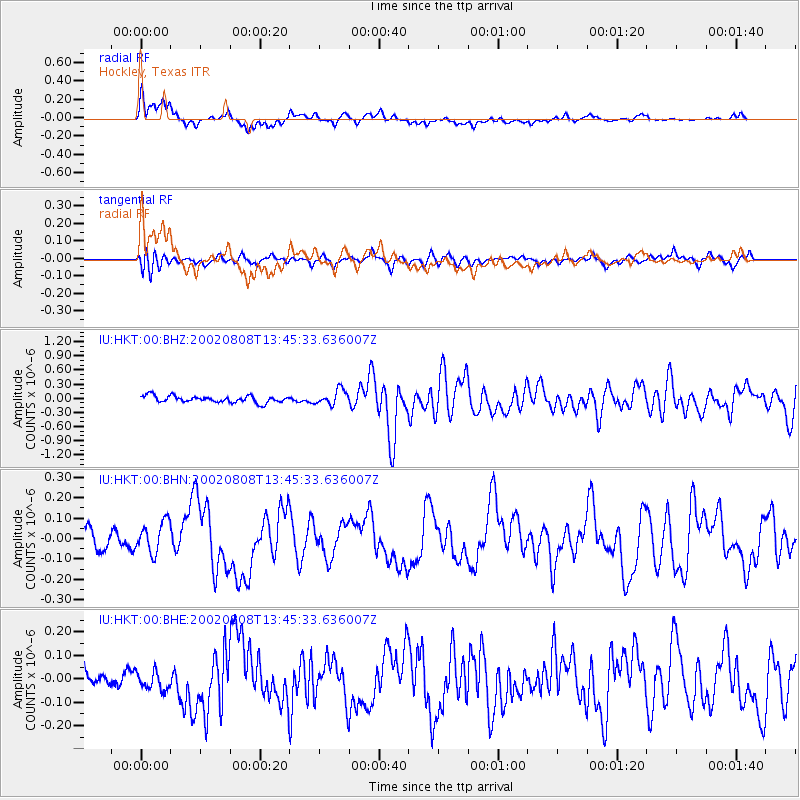
Signal To Noise
| Channel | StoN | STA | LTA |
| IU:HKT:00:BHN:20020808T13:45:33.636007Z | 1.8558869 | 8.00605E-8 | 4.3138677E-8 |
| IU:HKT:00:BHE:20020808T13:45:33.636007Z | 0.8251056 | 4.1551786E-8 | 5.0359354E-8 |
| IU:HKT:00:BHZ:20020808T13:45:33.636007Z | 2.2219923 | 1.5689388E-7 | 7.060955E-8 |
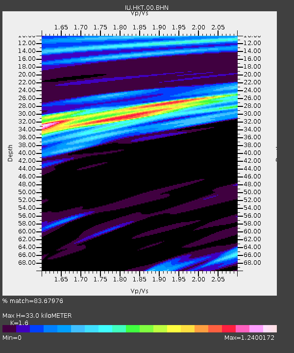
| Arrivals | |
| Ps | 3.8 SECOND |
| PpPs | 14 SECOND |
| PsPs/PpSs | 18 SECOND |

