You are here: Home > Network List > AK - Alaska Regional Network Stations List
> Station MDM Murphy Dome > Earthquake Result Viewer
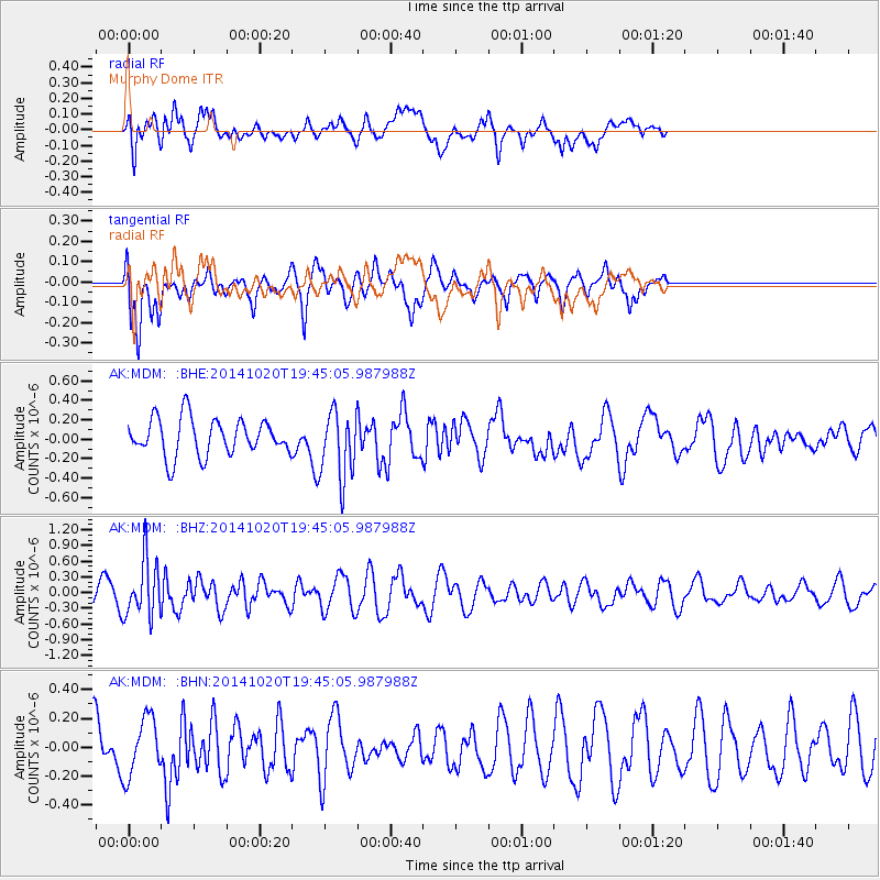
MDM Murphy Dome - Earthquake Result Viewer
*The percent match for this event was below the threshold and hence no stack was calculated.
| Earthquake location: |
Colombia-Ecuador Border Region |
| Earthquake latitude/longitude: |
0.6/-77.8 |
| Earthquake time(UTC): |
2014/10/20 (293) 19:33:21 GMT |
| Earthquake Depth: |
10 km |
| Earthquake Magnitude: |
6.0 MB, 5.6 MWB |
| Earthquake Catalog/Contributor: |
NEIC PDE/NEIC COMCAT |
|
| Network: |
AK Alaska Regional Network |
| Station: |
MDM Murphy Dome |
| Lat/Lon: |
64.96 N/148.23 W |
| Elevation: |
634 m |
|
| Distance: |
81.2 deg |
| Az: |
336.07 deg |
| Baz: |
107.637 deg |
| Ray Param: |
$rayparam |
*The percent match for this event was below the threshold and hence was not used in the summary stack. |
|
| Radial Match: |
60.82437 % |
| Radial Bump: |
400 |
| Transverse Match: |
48.507286 % |
| Transverse Bump: |
362 |
| SOD ConfigId: |
803114 |
| Insert Time: |
2014-11-03 19:36:30.049 +0000 |
| GWidth: |
2.5 |
| Max Bumps: |
400 |
| Tol: |
0.001 |
|
Signal To Noise
| Channel | StoN | STA | LTA |
| AK:MDM: :BHZ:20141020T19:45:05.987988Z | 3.335077 | 5.454412E-7 | 1.635468E-7 |
| AK:MDM: :BHN:20141020T19:45:05.987988Z | 0.86578244 | 2.0272603E-7 | 2.3415355E-7 |
| AK:MDM: :BHE:20141020T19:45:05.987988Z | 1.8408654 | 3.482017E-7 | 1.891511E-7 |
| Arrivals |
| Ps | |
| PpPs | |
| PsPs/PpSs | |


