You are here: Home > Network List > AZ - ANZA Regional Network Stations List
> Station LVA2 AZ.LVA2 > Earthquake Result Viewer
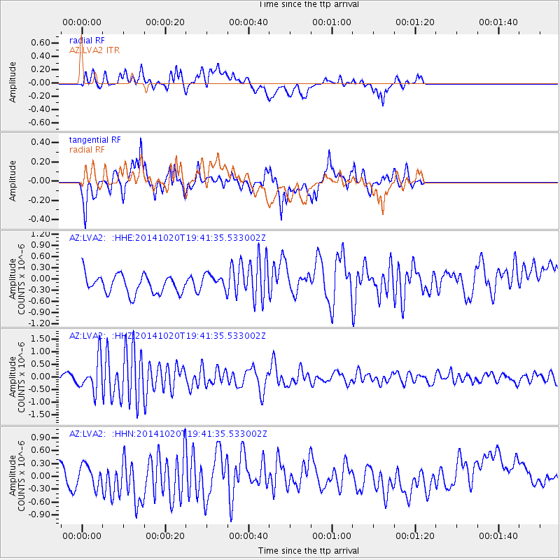
LVA2 AZ.LVA2 - Earthquake Result Viewer
*The percent match for this event was below the threshold and hence no stack was calculated.
| Earthquake location: |
Colombia-Ecuador Border Region |
| Earthquake latitude/longitude: |
0.6/-77.8 |
| Earthquake time(UTC): |
2014/10/20 (293) 19:33:21 GMT |
| Earthquake Depth: |
10 km |
| Earthquake Magnitude: |
6.0 MB, 5.6 MWB |
| Earthquake Catalog/Contributor: |
NEIC PDE/NEIC COMCAT |
|
| Network: |
AZ ANZA Regional Network |
| Station: |
LVA2 AZ.LVA2 |
| Lat/Lon: |
33.35 N/116.56 W |
| Elevation: |
1435 m |
|
| Distance: |
48.8 deg |
| Az: |
315.915 deg |
| Baz: |
123.781 deg |
| Ray Param: |
$rayparam |
*The percent match for this event was below the threshold and hence was not used in the summary stack. |
|
| Radial Match: |
33.10614 % |
| Radial Bump: |
400 |
| Transverse Match: |
66.88983 % |
| Transverse Bump: |
400 |
| SOD ConfigId: |
803114 |
| Insert Time: |
2014-11-03 19:38:56.319 +0000 |
| GWidth: |
2.5 |
| Max Bumps: |
400 |
| Tol: |
0.001 |
|
Signal To Noise
| Channel | StoN | STA | LTA |
| AZ:LVA2: :HHZ:20141020T19:41:35.533002Z | 2.6219306 | 6.484225E-7 | 2.4730724E-7 |
| AZ:LVA2: :HHN:20141020T19:41:35.533002Z | 0.8575627 | 2.4986778E-7 | 2.913697E-7 |
| AZ:LVA2: :HHE:20141020T19:41:35.533002Z | 0.89788735 | 2.2427068E-7 | 2.4977595E-7 |
| Arrivals |
| Ps | |
| PpPs | |
| PsPs/PpSs | |


