You are here: Home > Network List > AZ - ANZA Regional Network Stations List
> Station SMER AZ.SMER > Earthquake Result Viewer
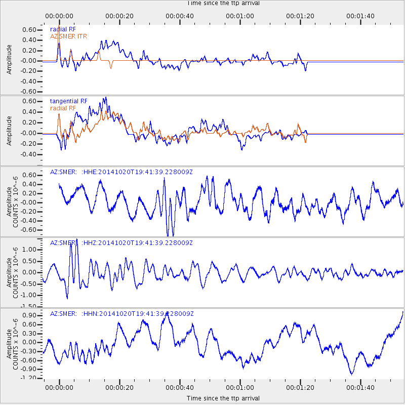
SMER AZ.SMER - Earthquake Result Viewer
*The percent match for this event was below the threshold and hence no stack was calculated.
| Earthquake location: |
Colombia-Ecuador Border Region |
| Earthquake latitude/longitude: |
0.6/-77.8 |
| Earthquake time(UTC): |
2014/10/20 (293) 19:33:21 GMT |
| Earthquake Depth: |
10 km |
| Earthquake Magnitude: |
6.0 MB, 5.6 MWB |
| Earthquake Catalog/Contributor: |
NEIC PDE/NEIC COMCAT |
|
| Network: |
AZ ANZA Regional Network |
| Station: |
SMER AZ.SMER |
| Lat/Lon: |
33.46 N/117.17 W |
| Elevation: |
355 m |
|
| Distance: |
49.3 deg |
| Az: |
315.659 deg |
| Baz: |
123.279 deg |
| Ray Param: |
$rayparam |
*The percent match for this event was below the threshold and hence was not used in the summary stack. |
|
| Radial Match: |
34.933624 % |
| Radial Bump: |
400 |
| Transverse Match: |
25.442368 % |
| Transverse Bump: |
400 |
| SOD ConfigId: |
803114 |
| Insert Time: |
2014-11-03 19:39:12.397 +0000 |
| GWidth: |
2.5 |
| Max Bumps: |
400 |
| Tol: |
0.001 |
|
Signal To Noise
| Channel | StoN | STA | LTA |
| AZ:SMER: :HHZ:20141020T19:41:39.228009Z | 3.4779055 | 5.885776E-7 | 1.6923335E-7 |
| AZ:SMER: :HHN:20141020T19:41:39.228009Z | 1.7062007 | 4.283098E-7 | 2.510313E-7 |
| AZ:SMER: :HHE:20141020T19:41:39.228009Z | 1.3835877 | 2.962072E-7 | 2.140863E-7 |
| Arrivals |
| Ps | |
| PpPs | |
| PsPs/PpSs | |


