You are here: Home > Network List > CN - Canadian National Seismograph Network Stations List
> Station INK INUVIK, NT > Earthquake Result Viewer
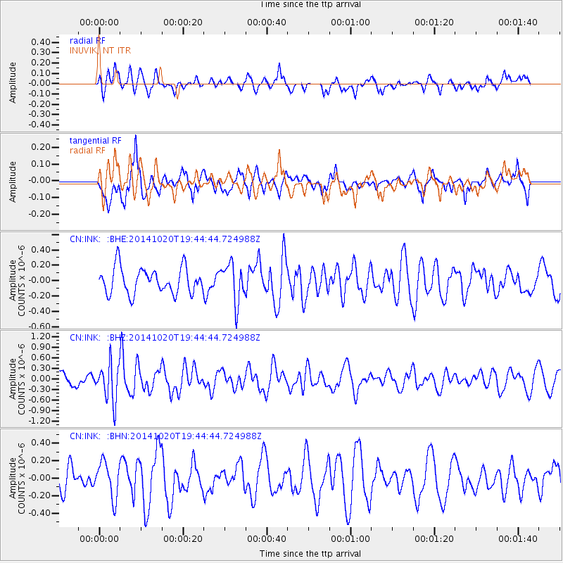
INK INUVIK, NT - Earthquake Result Viewer
*The percent match for this event was below the threshold and hence no stack was calculated.
| Earthquake location: |
Colombia-Ecuador Border Region |
| Earthquake latitude/longitude: |
0.6/-77.8 |
| Earthquake time(UTC): |
2014/10/20 (293) 19:33:21 GMT |
| Earthquake Depth: |
10 km |
| Earthquake Magnitude: |
6.0 MB, 5.6 MWB |
| Earthquake Catalog/Contributor: |
NEIC PDE/NEIC COMCAT |
|
| Network: |
CN Canadian National Seismograph Network |
| Station: |
INK INUVIK, NT |
| Lat/Lon: |
68.31 N/133.53 W |
| Elevation: |
44 m |
|
| Distance: |
77.3 deg |
| Az: |
341.657 deg |
| Baz: |
122.177 deg |
| Ray Param: |
$rayparam |
*The percent match for this event was below the threshold and hence was not used in the summary stack. |
|
| Radial Match: |
55.607445 % |
| Radial Bump: |
400 |
| Transverse Match: |
49.963066 % |
| Transverse Bump: |
400 |
| SOD ConfigId: |
803114 |
| Insert Time: |
2014-11-03 19:42:51.474 +0000 |
| GWidth: |
2.5 |
| Max Bumps: |
400 |
| Tol: |
0.001 |
|
Signal To Noise
| Channel | StoN | STA | LTA |
| CN:INK: :BHZ:20141020T19:44:44.724988Z | 3.471061 | 5.4963374E-7 | 1.5834748E-7 |
| CN:INK: :BHN:20141020T19:44:44.724988Z | 1.126585 | 2.1296681E-7 | 1.890375E-7 |
| CN:INK: :BHE:20141020T19:44:44.724988Z | 1.5408108 | 2.5855985E-7 | 1.6780766E-7 |
| Arrivals |
| Ps | |
| PpPs | |
| PsPs/PpSs | |


