You are here: Home > Network List > IW - Intermountain West Stations List
> Station MOOW Moose Ponds, Wyoming, USA > Earthquake Result Viewer
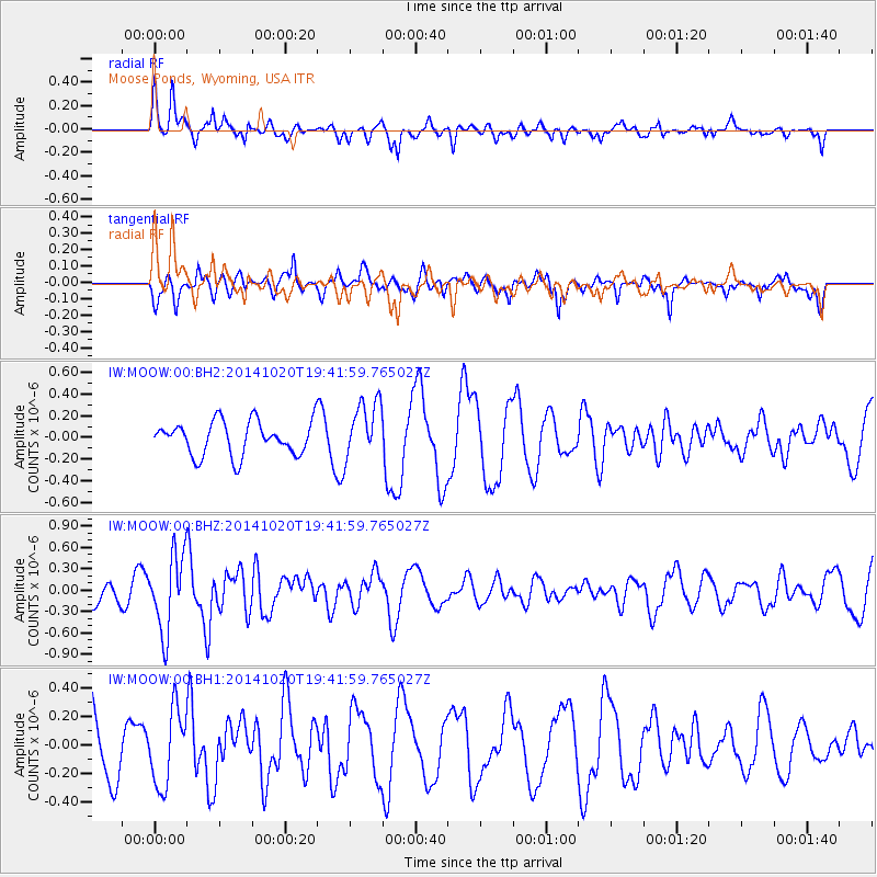
MOOW Moose Ponds, Wyoming, USA - Earthquake Result Viewer
*The percent match for this event was below the threshold and hence no stack was calculated.
| Earthquake location: |
Colombia-Ecuador Border Region |
| Earthquake latitude/longitude: |
0.6/-77.8 |
| Earthquake time(UTC): |
2014/10/20 (293) 19:33:21 GMT |
| Earthquake Depth: |
10 km |
| Earthquake Magnitude: |
6.0 MB, 5.6 MWB |
| Earthquake Catalog/Contributor: |
NEIC PDE/NEIC COMCAT |
|
| Network: |
IW Intermountain West |
| Station: |
MOOW Moose Ponds, Wyoming, USA |
| Lat/Lon: |
43.75 N/110.74 W |
| Elevation: |
2128 m |
|
| Distance: |
52.0 deg |
| Az: |
330.038 deg |
| Baz: |
136.44 deg |
| Ray Param: |
$rayparam |
*The percent match for this event was below the threshold and hence was not used in the summary stack. |
|
| Radial Match: |
56.429394 % |
| Radial Bump: |
400 |
| Transverse Match: |
50.418827 % |
| Transverse Bump: |
400 |
| SOD ConfigId: |
803114 |
| Insert Time: |
2014-11-03 19:48:12.524 +0000 |
| GWidth: |
2.5 |
| Max Bumps: |
400 |
| Tol: |
0.001 |
|
Signal To Noise
| Channel | StoN | STA | LTA |
| IW:MOOW:00:BHZ:20141020T19:41:59.765027Z | 2.1487727 | 5.422778E-7 | 2.5236628E-7 |
| IW:MOOW:00:BH1:20141020T19:41:59.765027Z | 1.2111439 | 2.652374E-7 | 2.1899744E-7 |
| IW:MOOW:00:BH2:20141020T19:41:59.765027Z | 1.7256448 | 2.6704447E-7 | 1.5475054E-7 |
| Arrivals |
| Ps | |
| PpPs | |
| PsPs/PpSs | |


