HKT Hockley, Texas - Earthquake Result Viewer
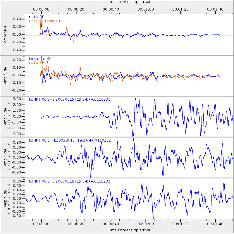
Earthquake location: Rat Islands, Aleutian Islands
Earthquake latitude/longitude: 51.6/176.9
Earthquake time(UTC): 2003/06/15 (166) 19:24:33 GMT
Earthquake Depth: 20 km
Earthquake Magnitude: 6.0 MB, 6.4 MS, 6.5 MW, 6.5 MW
Earthquake Catalog/Contributor: WHDF/NEIC
Network: IU Global Seismograph Network (GSN - IRIS/USGS)
Station: HKT Hockley, Texas
Lat/Lon: 29.96 N/95.84 W
Elevation: -413.0 m
Distance: 65.5 deg
Az: 72.242 deg
Baz: 316.749 deg
Ray Param: 0.058191705
Estimated Moho Depth: 29.75 km
Estimated Crust Vp/Vs: 1.63
Assumed Crust Vp: 5.581 km/s
Estimated Crust Vs: 3.419 km/s
Estimated Crust Poisson's Ratio: 0.20
Radial Match: 89.7955 %
Radial Bump: 378
Transverse Match: 82.66547 %
Transverse Bump: 400
SOD ConfigId: 4714
Insert Time: 2010-03-02 13:50:26.317 +0000
GWidth: 2.5
Max Bumps: 400
Tol: 0.001

Signal To Noise

ChannelStoNSTALTA
IU:HKT:00:BHN:20030615T19:34:44.011023Z1.26770728.046693E-86.347438E-8
IU:HKT:00:BHE:20030615T19:34:44.011023Z0.924922357.859375E-88.4973344E-8
IU:HKT:00:BHZ:20030615T19:34:44.011023Z2.51497652.9953696E-71.191013E-7
Arrivals
Ps3.5 SECOND
PpPs14 SECOND
PsPs/PpSs17 SECOND