
HKT Hockley, Texas - Earthquake Result Viewer
| ||||||||||||||||||
| ||||||||||||||||||
| ||||||||||||||||||
|
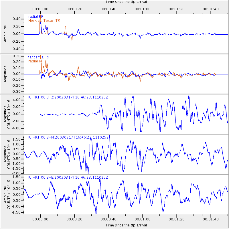
Signal To Noise
| Channel | StoN | STA | LTA |
| IU:HKT:00:BHN:20030317T16:46:23.111025Z | 0.93453324 | 2.464265E-7 | 2.636894E-7 |
| IU:HKT:00:BHE:20030317T16:46:23.111025Z | 0.642111 | 1.9190072E-7 | 2.9885913E-7 |
| IU:HKT:00:BHZ:20030317T16:46:23.111025Z | 3.4063308 | 4.62543E-7 | 1.3578922E-7 |
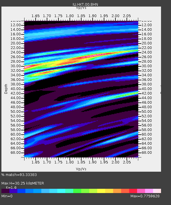
| Arrivals | |
| Ps | 3.4 SECOND |
| PpPs | 14 SECOND |
| PsPs/PpSs | 17 SECOND |

