
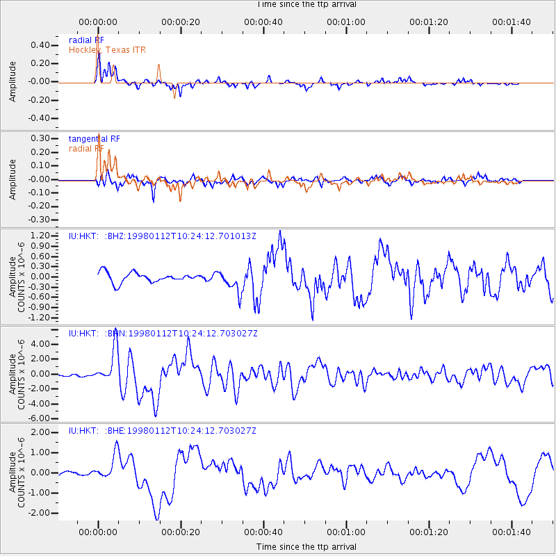
HKT Hockley, Texas - Earthquake Result Viewer
| ||||||||||||||||||
| ||||||||||||||||||
| ||||||||||||||||||
|
Signal To Noise
| Channel | StoN | STA | LTA |
| IU:HKT: :BHN:19980112T10:24:12.703027Z | 19.892935 | 2.496355E-6 | 1.2548952E-7 |
| IU:HKT: :BHE:19980112T10:24:12.703027Z | 3.7354472 | 6.4411233E-7 | 1.7243245E-7 |
| IU:HKT: :BHZ:19980112T10:24:12.701013Z | 2.3384228 | 3.3395258E-7 | 1.4281103E-7 |
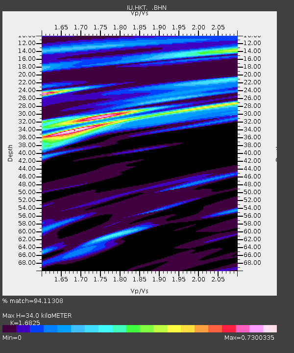
| Arrivals | |
| Ps | 4.3 SECOND |
| PpPs | 16 SECOND |
| PsPs/PpSs | 20 SECOND |

