
HKT Hockley, Texas - Earthquake Result Viewer
| ||||||||||||||||||
| ||||||||||||||||||
| ||||||||||||||||||
|
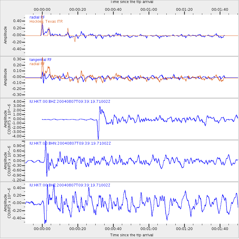
Signal To Noise
| Channel | StoN | STA | LTA |
| IU:HKT:00:BHN:20040807T09:39:19.71002Z | 6.71455 | 4.3999472E-7 | 6.5528546E-8 |
| IU:HKT:00:BHE:20040807T09:39:19.71002Z | 4.49448 | 2.6531083E-7 | 5.9030377E-8 |
| IU:HKT:00:BHZ:20040807T09:39:19.71002Z | 31.394474 | 1.9485624E-6 | 6.206705E-8 |
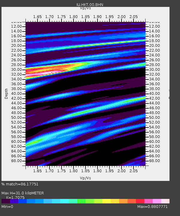
| Arrivals | |
| Ps | 4.1 SECOND |
| PpPs | 14 SECOND |
| PsPs/PpSs | 19 SECOND |

