
HKT Hockley, Texas - Earthquake Result Viewer
| ||||||||||||||||||
| ||||||||||||||||||
| ||||||||||||||||||
|
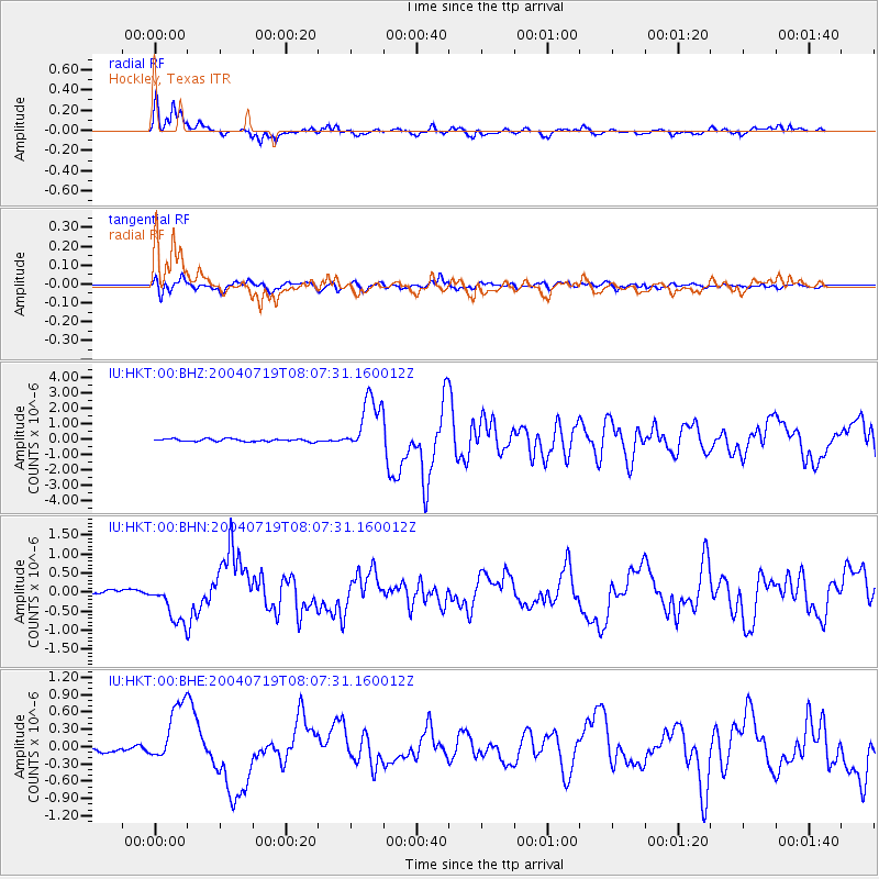
Signal To Noise
| Channel | StoN | STA | LTA |
| IU:HKT:00:BHN:20040719T08:07:31.160012Z | 13.117555 | 5.4611496E-7 | 4.1632372E-8 |
| IU:HKT:00:BHE:20040719T08:07:31.160012Z | 7.4838805 | 5.266007E-7 | 7.0364656E-8 |
| IU:HKT:00:BHZ:20040719T08:07:31.160012Z | 21.853865 | 1.8469741E-6 | 8.451476E-8 |
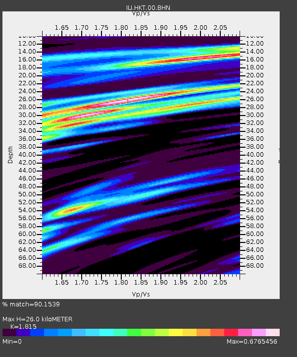
| Arrivals | |
| Ps | 4.0 SECOND |
| PpPs | 12 SECOND |
| PsPs/PpSs | 16 SECOND |

