HKT Hockley, Texas - Earthquake Result Viewer
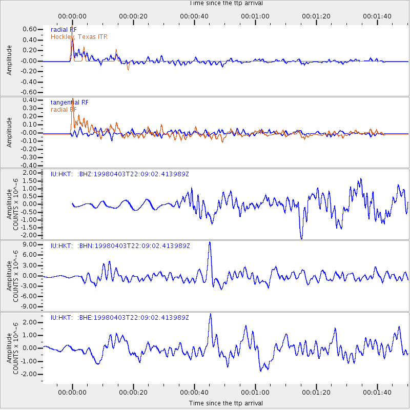
Earthquake location: Peru-Brazil Border Region
Earthquake latitude/longitude: -8.1/-74.2
Earthquake time(UTC): 1998/04/03 (093) 22:01:48 GMT
Earthquake Depth: 165 km
Earthquake Magnitude: 6.1 MB, 5.6 MS, 6.6 UNKNOWN, 6.6 MW
Earthquake Catalog/Contributor: WHDF/NEIC
Network: IU Global Seismograph Network (GSN - IRIS/USGS)
Station: HKT Hockley, Texas
Lat/Lon: 29.96 N/95.84 W
Elevation: -413.0 m
Distance: 43.2 deg
Az: 332.186 deg
Baz: 147.837 deg
Ray Param: 0.07206737
Estimated Moho Depth: 32.5 km
Estimated Crust Vp/Vs: 1.63
Assumed Crust Vp: 5.581 km/s
Estimated Crust Vs: 3.429 km/s
Estimated Crust Poisson's Ratio: 0.20
Radial Match: 87.600105 %
Radial Bump: 400
Transverse Match: 72.95688 %
Transverse Bump: 400
SOD ConfigId: 4480
Insert Time: 2010-03-02 13:51:26.161 +0000
GWidth: 2.5
Max Bumps: 400
Tol: 0.001

Signal To Noise

ChannelStoNSTALTA
IU:HKT: :BHN:19980403T22:09:02.413989Z4.4744036.715449E-71.5008592E-7
IU:HKT: :BHE:19980403T22:09:02.413989Z1.57454181.6124821E-71.024096E-7
IU:HKT: :BHZ:19980403T22:09:02.413989Z0.58870011.04319874E-71.7720376E-7
Arrivals
Ps3.9 SECOND
PpPs15 SECOND
PsPs/PpSs18 SECOND