HKT Hockley, Texas - Earthquake Result Viewer
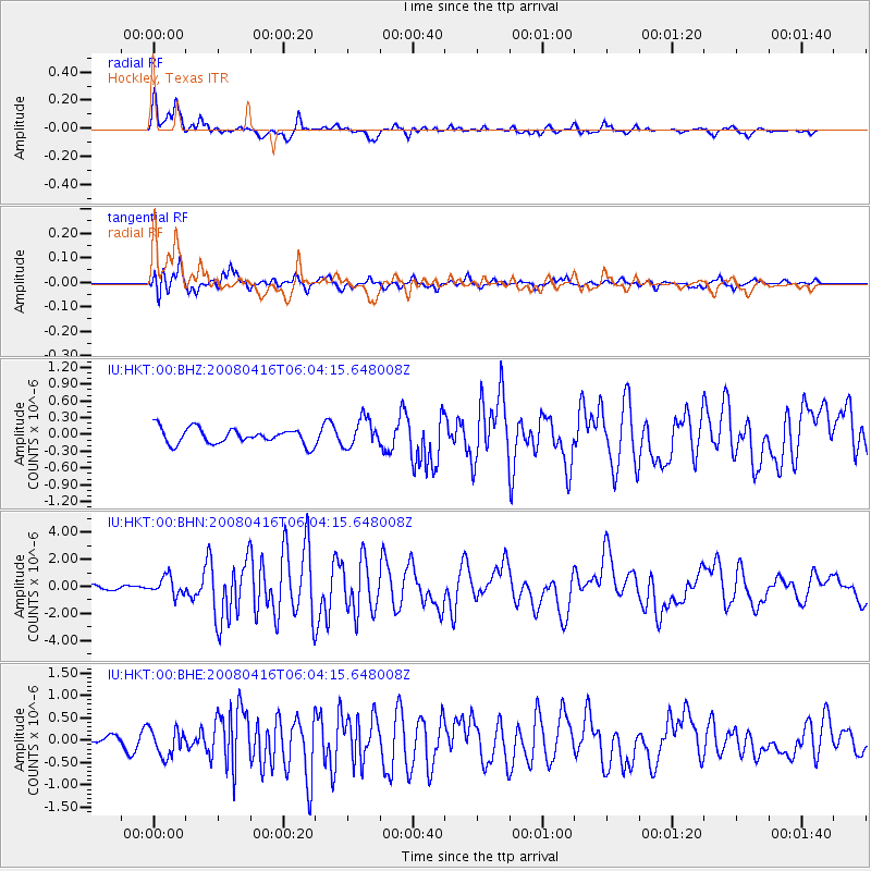
Earthquake location: Andreanof Islands, Aleutian Is.
Earthquake latitude/longitude: 51.9/-179.2
Earthquake time(UTC): 2008/04/16 (107) 05:54:19 GMT
Earthquake Depth: 13 km
Earthquake Magnitude: 6.1 MB, 6.5 MS, 6.6 MW, 6.6 MW
Earthquake Catalog/Contributor: WHDF/NEIC
Network: IU Global Seismograph Network (GSN - IRIS/USGS)
Station: HKT Hockley, Texas
Lat/Lon: 29.96 N/95.84 W
Elevation: -413.0 m
Distance: 63.1 deg
Az: 75.127 deg
Baz: 316.338 deg
Ray Param: 0.059789084
Estimated Moho Depth: 29.0 km
Estimated Crust Vp/Vs: 1.66
Assumed Crust Vp: 5.581 km/s
Estimated Crust Vs: 3.362 km/s
Estimated Crust Poisson's Ratio: 0.22
Radial Match: 94.16135 %
Radial Bump: 362
Transverse Match: 85.61307 %
Transverse Bump: 400
SOD ConfigId: 2504
Insert Time: 2010-03-02 13:51:32.958 +0000
GWidth: 2.5
Max Bumps: 400
Tol: 0.001

Signal To Noise

ChannelStoNSTALTA
IU:HKT:00:BHN:20080416T06:04:15.648008Z5.37725546.736508E-71.2527781E-7
IU:HKT:00:BHE:20080416T06:04:15.648008Z3.98052293.0609542E-77.689829E-8
IU:HKT:00:BHZ:20080416T06:04:15.648008Z1.7906642.4859816E-71.3883016E-7
Arrivals
Ps3.6 SECOND
PpPs13 SECOND
PsPs/PpSs17 SECOND