
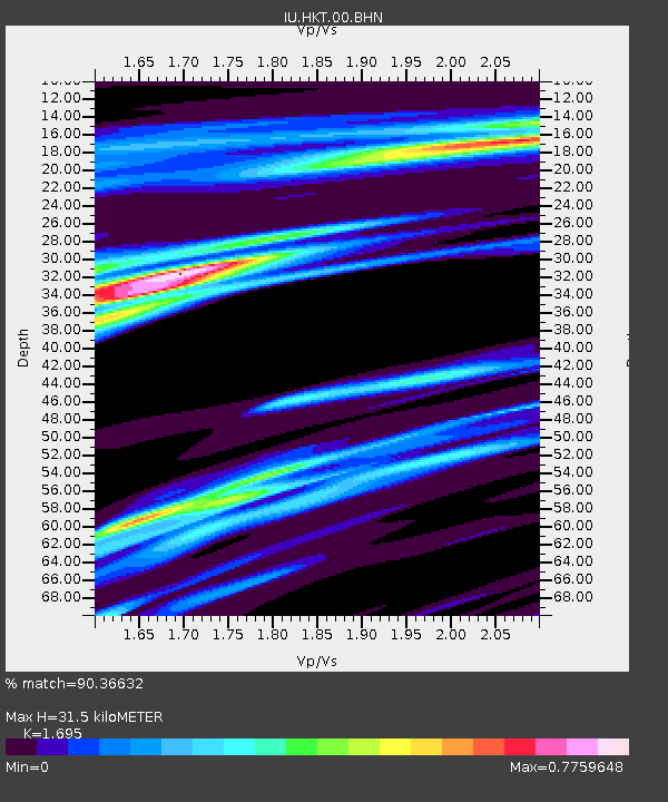
HKT Hockley, Texas - Earthquake Result Viewer
| ||||||||||||||||||
| ||||||||||||||||||
| ||||||||||||||||||
|
Signal To Noise
| Channel | StoN | STA | LTA |
| IU:HKT:00:BHN:20080502T01:43:26.52302Z | 1.6407468 | 2.9185398E-6 | 1.7787875E-6 |
| IU:HKT:00:BHE:20080502T01:43:26.52302Z | 1.9600173 | 8.0287884E-7 | 4.0962843E-7 |
| IU:HKT:00:BHZ:20080502T01:43:26.52302Z | 1.4245381 | 4.0546044E-7 | 2.8462588E-7 |
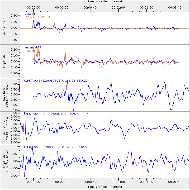
| Arrivals | |
| Ps | 4.1 SECOND |
| PpPs | 15 SECOND |
| PsPs/PpSs | 19 SECOND |

