You are here: Home > Network List > TA - USArray Transportable Network (new EarthScope stations) Stations List
> Station M61A Granite Springs, NY, USA > Earthquake Result Viewer
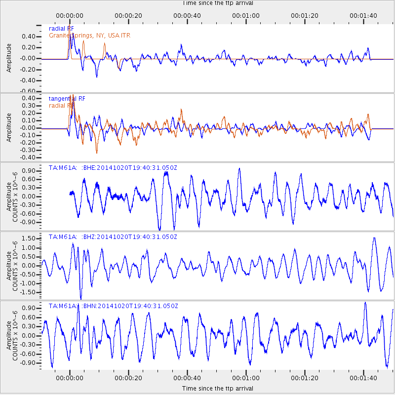
M61A Granite Springs, NY, USA - Earthquake Result Viewer
*The percent match for this event was below the threshold and hence no stack was calculated.
| Earthquake location: |
Colombia-Ecuador Border Region |
| Earthquake latitude/longitude: |
0.6/-77.8 |
| Earthquake time(UTC): |
2014/10/20 (293) 19:33:21 GMT |
| Earthquake Depth: |
10 km |
| Earthquake Magnitude: |
6.0 MB, 5.6 MWB |
| Earthquake Catalog/Contributor: |
NEIC PDE/NEIC COMCAT |
|
| Network: |
TA USArray Transportable Network (new EarthScope stations) |
| Station: |
M61A Granite Springs, NY, USA |
| Lat/Lon: |
41.31 N/73.77 W |
| Elevation: |
190 m |
|
| Distance: |
40.7 deg |
| Az: |
4.715 deg |
| Baz: |
186.264 deg |
| Ray Param: |
$rayparam |
*The percent match for this event was below the threshold and hence was not used in the summary stack. |
|
| Radial Match: |
67.08296 % |
| Radial Bump: |
400 |
| Transverse Match: |
59.90543 % |
| Transverse Bump: |
400 |
| SOD ConfigId: |
803114 |
| Insert Time: |
2014-11-03 20:03:41.207 +0000 |
| GWidth: |
2.5 |
| Max Bumps: |
400 |
| Tol: |
0.001 |
|
Signal To Noise
| Channel | StoN | STA | LTA |
| TA:M61A: :BHZ:20141020T19:40:31.050Z | 2.7581396 | 8.8865573E-7 | 3.221939E-7 |
| TA:M61A: :BHN:20141020T19:40:31.050Z | 1.4659631 | 4.7909265E-7 | 3.2681083E-7 |
| TA:M61A: :BHE:20141020T19:40:31.050Z | 2.374275 | 6.7635534E-7 | 2.8486818E-7 |
| Arrivals |
| Ps | |
| PpPs | |
| PsPs/PpSs | |


