You are here: Home > Network List > TA - USArray Transportable Network (new EarthScope stations) Stations List
> Station MSTX Muleshoe, TX, USA > Earthquake Result Viewer
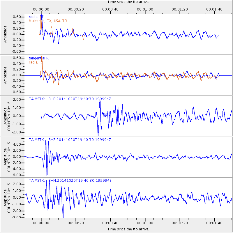
MSTX Muleshoe, TX, USA - Earthquake Result Viewer
*The percent match for this event was below the threshold and hence no stack was calculated.
| Earthquake location: |
Colombia-Ecuador Border Region |
| Earthquake latitude/longitude: |
0.6/-77.8 |
| Earthquake time(UTC): |
2014/10/20 (293) 19:33:21 GMT |
| Earthquake Depth: |
10 km |
| Earthquake Magnitude: |
6.0 MB, 5.6 MWB |
| Earthquake Catalog/Contributor: |
NEIC PDE/NEIC COMCAT |
|
| Network: |
TA USArray Transportable Network (new EarthScope stations) |
| Station: |
MSTX Muleshoe, TX, USA |
| Lat/Lon: |
33.97 N/102.77 W |
| Elevation: |
1167 m |
|
| Distance: |
40.6 deg |
| Az: |
327.437 deg |
| Baz: |
139.639 deg |
| Ray Param: |
$rayparam |
*The percent match for this event was below the threshold and hence was not used in the summary stack. |
|
| Radial Match: |
79.180046 % |
| Radial Bump: |
358 |
| Transverse Match: |
72.04833 % |
| Transverse Bump: |
400 |
| SOD ConfigId: |
803114 |
| Insert Time: |
2014-11-03 20:03:53.813 +0000 |
| GWidth: |
2.5 |
| Max Bumps: |
400 |
| Tol: |
0.001 |
|
Signal To Noise
| Channel | StoN | STA | LTA |
| TA:MSTX: :BHZ:20141020T19:40:30.199994Z | 9.658424 | 2.7870622E-6 | 2.8856283E-7 |
| TA:MSTX: :BHN:20141020T19:40:30.199994Z | 4.483382 | 1.2175725E-6 | 2.7157455E-7 |
| TA:MSTX: :BHE:20141020T19:40:30.199994Z | 4.909709 | 1.0156962E-6 | 2.0687504E-7 |
| Arrivals |
| Ps | |
| PpPs | |
| PsPs/PpSs | |


