You are here: Home > Network List > TA - USArray Transportable Network (new EarthScope stations) Stations List
> Station Q61A Milford, DE, USA > Earthquake Result Viewer
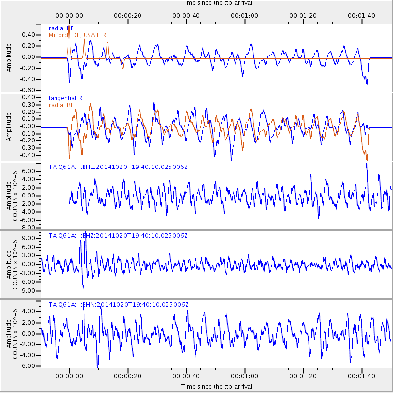
Q61A Milford, DE, USA - Earthquake Result Viewer
*The percent match for this event was below the threshold and hence no stack was calculated.
| Earthquake location: |
Colombia-Ecuador Border Region |
| Earthquake latitude/longitude: |
0.6/-77.8 |
| Earthquake time(UTC): |
2014/10/20 (293) 19:33:21 GMT |
| Earthquake Depth: |
10 km |
| Earthquake Magnitude: |
6.0 MB, 5.6 MWB |
| Earthquake Catalog/Contributor: |
NEIC PDE/NEIC COMCAT |
|
| Network: |
TA USArray Transportable Network (new EarthScope stations) |
| Station: |
Q61A Milford, DE, USA |
| Lat/Lon: |
38.88 N/75.33 W |
| Elevation: |
5.0 m |
|
| Distance: |
38.2 deg |
| Az: |
3.185 deg |
| Baz: |
184.082 deg |
| Ray Param: |
$rayparam |
*The percent match for this event was below the threshold and hence was not used in the summary stack. |
|
| Radial Match: |
47.21284 % |
| Radial Bump: |
400 |
| Transverse Match: |
57.2365 % |
| Transverse Bump: |
400 |
| SOD ConfigId: |
803114 |
| Insert Time: |
2014-11-03 20:05:49.951 +0000 |
| GWidth: |
2.5 |
| Max Bumps: |
400 |
| Tol: |
0.001 |
|
Signal To Noise
| Channel | StoN | STA | LTA |
| TA:Q61A: :BHZ:20141020T19:40:10.025006Z | 2.134101 | 3.3300864E-6 | 1.5604164E-6 |
| TA:Q61A: :BHN:20141020T19:40:10.025006Z | 1.2000644 | 1.725286E-6 | 1.4376611E-6 |
| TA:Q61A: :BHE:20141020T19:40:10.025006Z | 1.2453687 | 2.3699297E-6 | 1.9029943E-6 |
| Arrivals |
| Ps | |
| PpPs | |
| PsPs/PpSs | |


