
HKT Hockley, Texas - Earthquake Result Viewer
| ||||||||||||||||||
| ||||||||||||||||||
| ||||||||||||||||||
|
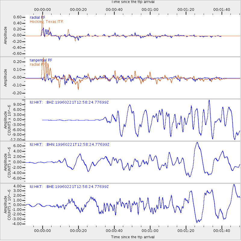
Signal To Noise
| Channel | StoN | STA | LTA |
| IU:HKT: :BHN:19960221T12:58:24.77699Z | 2.7734046 | 1.9311052E-7 | 6.9629415E-8 |
| IU:HKT: :BHE:19960221T12:58:24.77699Z | 0.75625306 | 1.3312368E-7 | 1.7603058E-7 |
| IU:HKT: :BHZ:19960221T12:58:24.77699Z | 5.473725 | 5.469643E-7 | 9.992543E-8 |
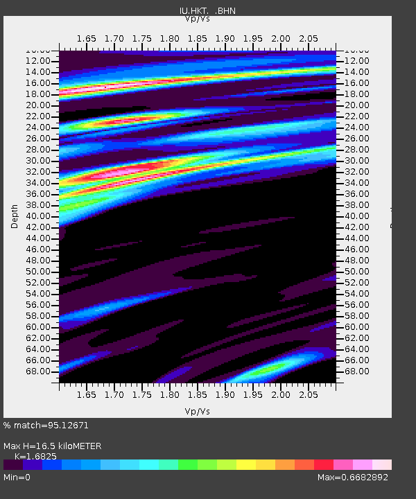
| Arrivals | |
| Ps | 2.1 SECOND |
| PpPs | 7.5 SECOND |
| PsPs/PpSs | 9.7 SECOND |

