You are here: Home > Network List > TA - USArray Transportable Network (new EarthScope stations) Stations List
> Station T53A Wise, VA, USA > Earthquake Result Viewer
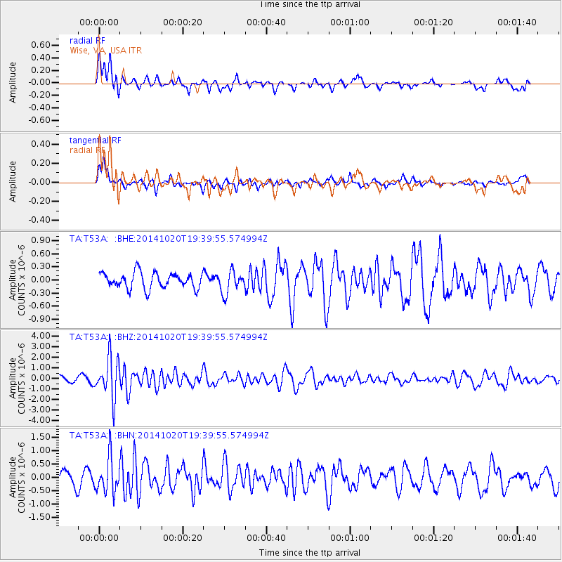
T53A Wise, VA, USA - Earthquake Result Viewer
*The percent match for this event was below the threshold and hence no stack was calculated.
| Earthquake location: |
Colombia-Ecuador Border Region |
| Earthquake latitude/longitude: |
0.6/-77.8 |
| Earthquake time(UTC): |
2014/10/20 (293) 19:33:21 GMT |
| Earthquake Depth: |
10 km |
| Earthquake Magnitude: |
6.0 MB, 5.6 MWB |
| Earthquake Catalog/Contributor: |
NEIC PDE/NEIC COMCAT |
|
| Network: |
TA USArray Transportable Network (new EarthScope stations) |
| Station: |
T53A Wise, VA, USA |
| Lat/Lon: |
36.98 N/82.54 W |
| Elevation: |
818 m |
|
| Distance: |
36.5 deg |
| Az: |
353.679 deg |
| Baz: |
172.098 deg |
| Ray Param: |
$rayparam |
*The percent match for this event was below the threshold and hence was not used in the summary stack. |
|
| Radial Match: |
65.62494 % |
| Radial Bump: |
400 |
| Transverse Match: |
58.584034 % |
| Transverse Bump: |
372 |
| SOD ConfigId: |
803114 |
| Insert Time: |
2014-11-03 20:06:51.132 +0000 |
| GWidth: |
2.5 |
| Max Bumps: |
400 |
| Tol: |
0.001 |
|
Signal To Noise
| Channel | StoN | STA | LTA |
| TA:T53A: :BHZ:20141020T19:39:55.574994Z | 5.4939704 | 1.9699391E-6 | 3.5856385E-7 |
| TA:T53A: :BHN:20141020T19:39:55.574994Z | 2.1780696 | 6.7137495E-7 | 3.0824313E-7 |
| TA:T53A: :BHE:20141020T19:39:55.574994Z | 1.4680786 | 2.636858E-7 | 1.7961285E-7 |
| Arrivals |
| Ps | |
| PpPs | |
| PsPs/PpSs | |


