
HKT Hockley, Texas - Earthquake Result Viewer
| ||||||||||||||||||
| ||||||||||||||||||
| ||||||||||||||||||
|
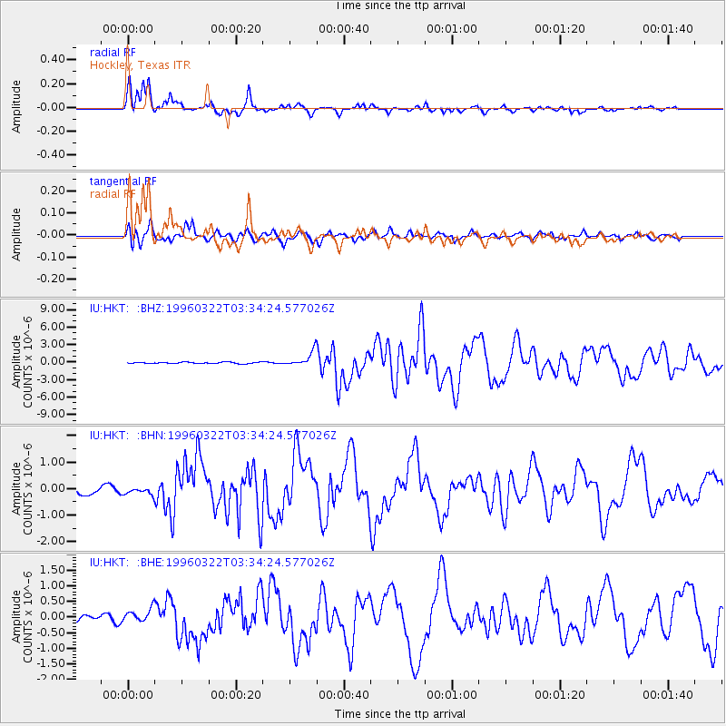
Signal To Noise
| Channel | StoN | STA | LTA |
| IU:HKT: :BHN:19960322T03:34:24.577026Z | 0.5232158 | 1.2117701E-7 | 2.3160047E-7 |
| IU:HKT: :BHE:19960322T03:34:24.577026Z | 1.1204326 | 2.0642214E-7 | 1.8423432E-7 |
| IU:HKT: :BHZ:19960322T03:34:24.577026Z | 10.6257 | 1.2524862E-6 | 1.1787329E-7 |
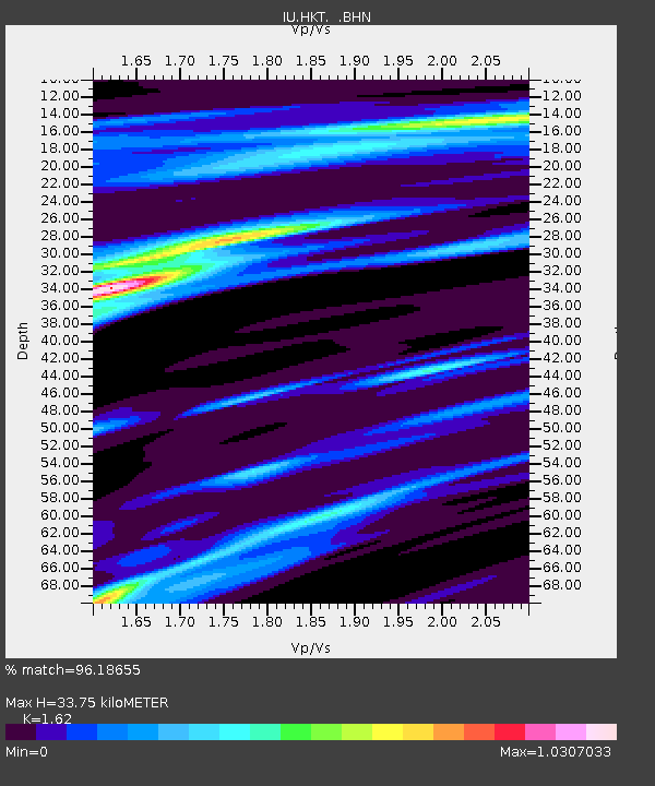
| Arrivals | |
| Ps | 3.9 SECOND |
| PpPs | 15 SECOND |
| PsPs/PpSs | 19 SECOND |

