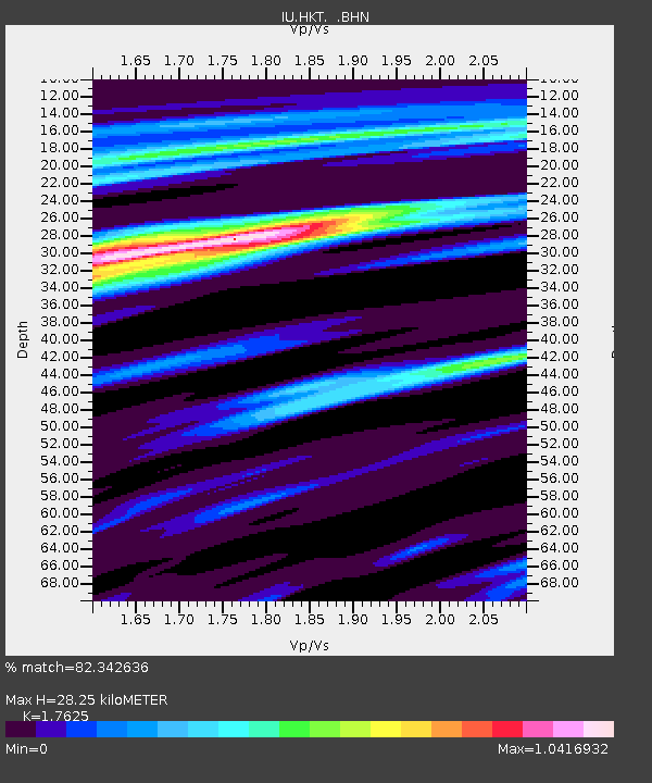
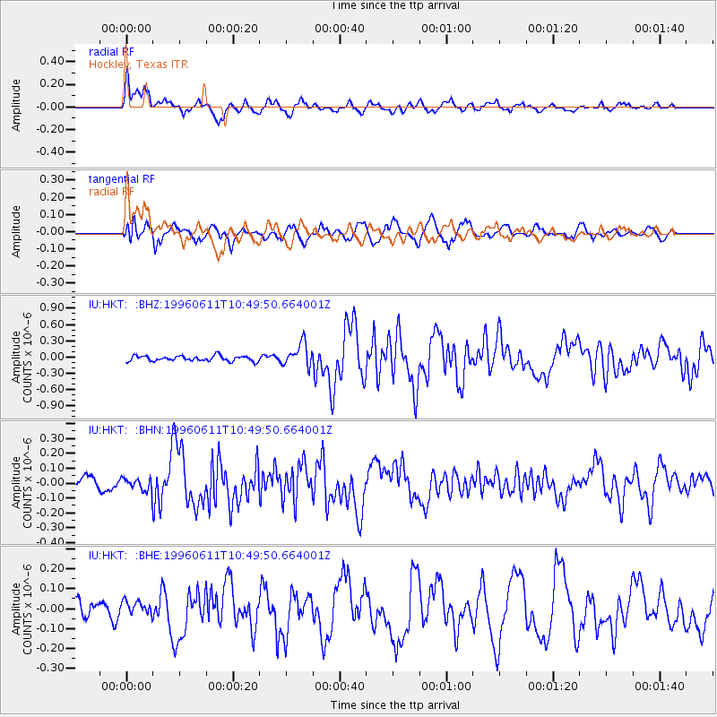
HKT Hockley, Texas - Earthquake Result Viewer

Earthquake location: Andreanof Islands, Aleutian Is.
Earthquake latitude/longitude: 51.3/-176.3
Earthquake time(UTC): 1996/06/11 (163) 10:40:08 GMT
Earthquake Depth: 33 km
Earthquake Magnitude: 5.6 MB, 5.6 MS, 6.0 UNKNOWN, 5.5 MS
Earthquake Catalog/Contributor: WHDF/NEIC
Network: IU Global Seismograph Network (GSN - IRIS/USGS)
Station: HKT Hockley, Texas
Lat/Lon: 29.96 N/95.84 W
Elevation: -413.0 m
Distance: 61.5 deg
Az: 76.863 deg
Baz: 315.181 deg
Ray Param: 0.06078956
Estimated Moho Depth: 28.25 km
Estimated Crust Vp/Vs: 1.76
Assumed Crust Vp: 5.581 km/s
Estimated Crust Vs: 3.167 km/s
Estimated Crust Poisson's Ratio: 0.26
Radial Match: 82.342636 %
Radial Bump: 400
Transverse Match: 74.53562 %
Transverse Bump: 400
SOD ConfigId: 6273
Insert Time: 2010-03-02 13:52:46.182 +0000
GWidth: 2.5
Max Bumps: 400
Tol: 0.001

Signal To Noise

ChannelStoNSTALTA
IU:HKT: :BHN:19960611T10:49:50.664001Z0.7049834.249097E-86.0272335E-8
IU:HKT: :BHE:19960611T10:49:50.664001Z0.68922613.459337E-85.0191616E-8
IU:HKT: :BHZ:19960611T10:49:50.664001Z4.4248612.1326225E-74.8196373E-8
Arrivals
Ps4.0 SECOND
PpPs14 SECOND
PsPs/PpSs18 SECOND