You are here: Home > Network List > US - United States National Seismic Network Stations List
> Station DUG Dugway, Tooele County, Utah, USA > Earthquake Result Viewer
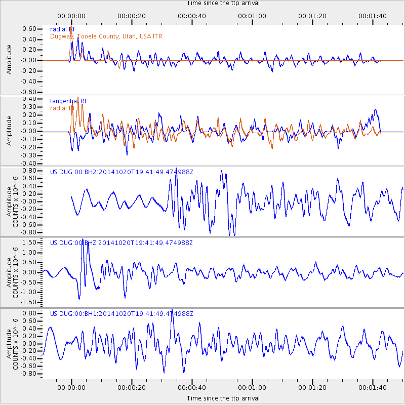
DUG Dugway, Tooele County, Utah, USA - Earthquake Result Viewer
*The percent match for this event was below the threshold and hence no stack was calculated.
| Earthquake location: |
Colombia-Ecuador Border Region |
| Earthquake latitude/longitude: |
0.6/-77.8 |
| Earthquake time(UTC): |
2014/10/20 (293) 19:33:21 GMT |
| Earthquake Depth: |
10 km |
| Earthquake Magnitude: |
6.0 MB, 5.6 MWB |
| Earthquake Catalog/Contributor: |
NEIC PDE/NEIC COMCAT |
|
| Network: |
US United States National Seismic Network |
| Station: |
DUG Dugway, Tooele County, Utah, USA |
| Lat/Lon: |
40.19 N/112.81 W |
| Elevation: |
1477 m |
|
| Distance: |
50.6 deg |
| Az: |
325.403 deg |
| Baz: |
132.163 deg |
| Ray Param: |
$rayparam |
*The percent match for this event was below the threshold and hence was not used in the summary stack. |
|
| Radial Match: |
64.95507 % |
| Radial Bump: |
400 |
| Transverse Match: |
67.67605 % |
| Transverse Bump: |
400 |
| SOD ConfigId: |
803114 |
| Insert Time: |
2014-11-03 20:10:03.195 +0000 |
| GWidth: |
2.5 |
| Max Bumps: |
400 |
| Tol: |
0.001 |
|
Signal To Noise
| Channel | StoN | STA | LTA |
| US:DUG:00:BHZ:20141020T19:41:49.474988Z | 7.3234057 | 7.2756615E-7 | 9.9348064E-8 |
| US:DUG:00:BH1:20141020T19:41:49.474988Z | 0.6863192 | 1.686952E-7 | 2.4579703E-7 |
| US:DUG:00:BH2:20141020T19:41:49.474988Z | 2.1125576 | 3.228479E-7 | 1.5282323E-7 |
| Arrivals |
| Ps | |
| PpPs | |
| PsPs/PpSs | |


