HKT Hockley, Texas - Earthquake Result Viewer
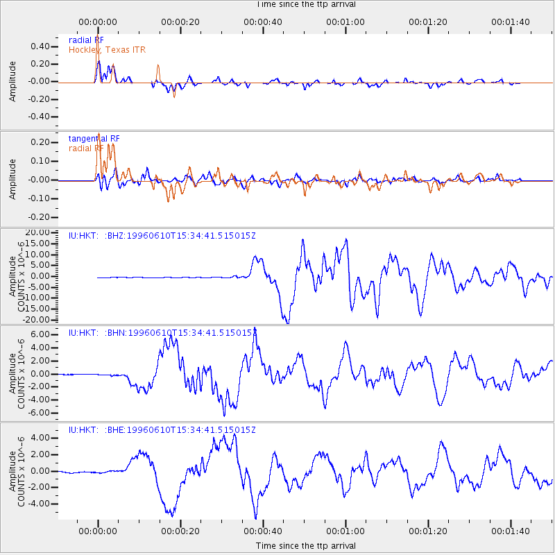
Earthquake location: Andreanof Islands, Aleutian Is.
Earthquake latitude/longitude: 51.5/-176.8
Earthquake time(UTC): 1996/06/10 (162) 15:24:56 GMT
Earthquake Depth: 26 km
Earthquake Magnitude: 5.9 MB, 7.1 MS, 7.2 UNKNOWN, 6.9 MS
Earthquake Catalog/Contributor: WHDF/NEIC
Network: IU Global Seismograph Network (GSN - IRIS/USGS)
Station: HKT Hockley, Texas
Lat/Lon: 29.96 N/95.84 W
Elevation: -413.0 m
Distance: 61.8 deg
Az: 76.554 deg
Baz: 315.502 deg
Ray Param: 0.060608093
Estimated Moho Depth: 31.0 km
Estimated Crust Vp/Vs: 1.63
Assumed Crust Vp: 5.581 km/s
Estimated Crust Vs: 3.424 km/s
Estimated Crust Poisson's Ratio: 0.20
Radial Match: 98.096504 %
Radial Bump: 359
Transverse Match: 92.519684 %
Transverse Bump: 400
SOD ConfigId: 6273
Insert Time: 2010-03-02 13:52:49.405 +0000
GWidth: 2.5
Max Bumps: 400
Tol: 0.001

Signal To Noise

ChannelStoNSTALTA
IU:HKT: :BHN:19960610T15:34:41.515015Z1.67085448.537653E-85.1097526E-8
IU:HKT: :BHE:19960610T15:34:41.515015Z1.8714521.1922647E-76.370801E-8
IU:HKT: :BHZ:19960610T15:34:41.515015Z4.64808233.165828E-76.811042E-8
Arrivals
Ps3.6 SECOND
PpPs14 SECOND
PsPs/PpSs18 SECOND